| Home | Newsletter | Locations | Diary |
|
Indexes |
|
|
|
|
|
|||||||||||||||||||||||||||||||||||||||||||||||||||||||||||||||||||||||||||||||||||||||||||||||||||||||||||||||||||||||||||||||||||||||||||||||||||||||||||||||||
|
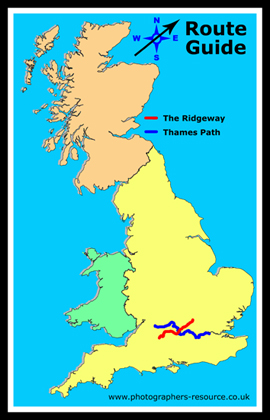
Start:
SU118680
Map multimap
End: SP959168
Map multimap shown in red on the map, the blue line is the Thames Path.
This route guide is in 3 parts:-
Part 2 - route from Overton Hill to the River Thames Taking the route from south, Avebury, to north, Ivinghoe Beacon The path starts at Overton Hill where The
Ridgeway joins the A4, not far from
Avebury
There are a lot of points of interest in this area including:- The Sanctuary, some markers in rings that show where a building or structure existed from the time of the Stone Circle, and is where the avenue terminates, many think this was the start point for processions.
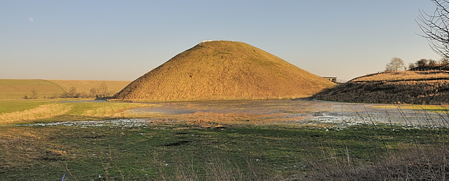
Silbury Hill is a largely manmade hill and the largest manmade hill in Europe, no one knows its purpose.
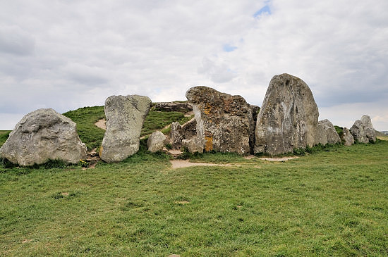
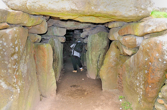
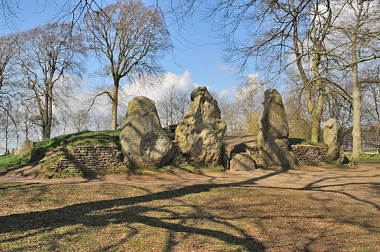
West Kennet Long Barrow is the best preserved of the larger long barrows and far larger than others, you can walk into this and explore 5 chambers inside. It is located on the top of a hill on the opposite side of the A4 to Silbury hill across 2 fields.
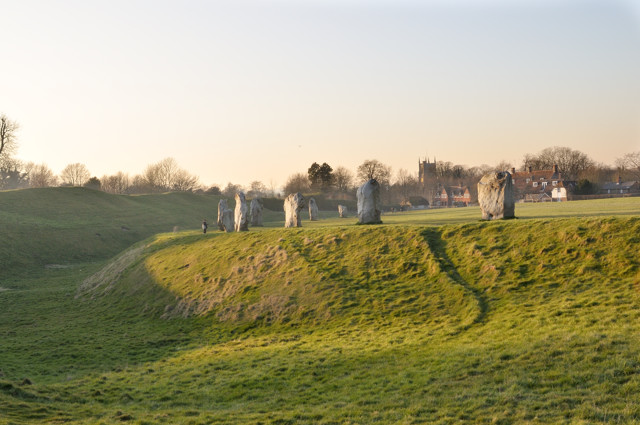
Avebury Stone Circle is the largest and although partly reconstructed, the most complete of all the larger stone circles. If you haven't visited this before, and you are going into this area its something that you will not want to miss. The Avenue is two lines of stones that g from the Avebury Circle to The Sanctuary, and although not complete there is a significant portion that is.
While in this route guide I am covering the items as if you walked the path, most iff not all of the features can be reached from car parks along its length, and in just about all cases I have included grid references and map links so that you can work out where each feature is located.
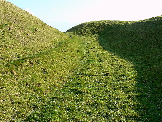
On leaving from Overton Hill you pass some barrows, thought to have
been burial mounds. See
Google aerial view
Fyfield Down and Overton Down - To the right of the Ridgeway, but also in places passing through, is an area known as Grey Wethers. This is an area where there are naturally a lot of sarsen stones, like those that Avebury is constructed of, sticking out of the ground, the track coming up from Avebury and crossing the Ridgeway at
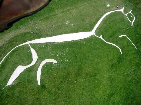
We look in more detail at white horses and
hillside features below when we get to looking at the
Uffington
White Horse.
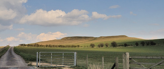
3 small circular woods that are visible landmarks for many miles, are passed on the left. Barbury Castle is not on the Ridgeway, but most people take the diversion of a couple of fields at most, to go through it and out into the car park beyond.
Photo By
Martyn Pattison
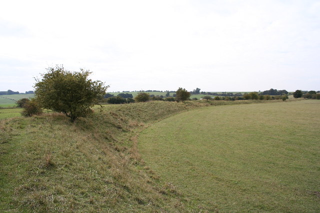
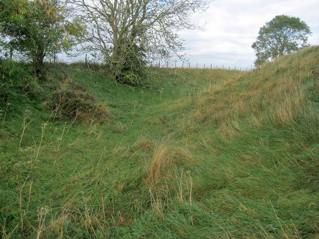
The Ridgeway passes below and to the north of Barbury Castle and becomes a road instead of a track for a distance. There are a number of these earthwork castles along its route, and in each case it passes very near, but not through the castle. This may have been a security feature, or perhaps animal herds being driven were not wanted in the settlement or it may just be that with the enclosures being created that some tracks were selected in each of these areas and the simplest to fence was the ones that went past rather than through earthworks. In many cases, but not all, it is also the route that is easiest to travel. Wiltshire has over 40 of these castles/forts/camps most at high points offering good visibility. While most of the Ridgeway provides good views, where you can often see for very many miles, you will find the view from the castles in each case is particularly good.
There are a number of long barrows and many other types of barrows and mounds alongside the Ridgeway, most are thought to have been burial mounds. Long barrows found on the Ridgeway and in some areas extending from it, such as in Somerset and Gloucestershire are of a design that involves a number of chambers off a central passageway. Before setting out on this walk we mentioned West Kennet Long Barrow, which is the largest and best example, being largely complete. Wayland Smithy, is a smaller multi-chambered long barrow just to the north and accessible off the Ridgeway. There is a legend that if you leave a horse tied up at it over night ,when you come back in the morning it will have new shoes. If not travelling along this path, but visiting the White Horse and Castle at Uffington, then this is a short walk south, and on the way back there is a short cut back to the car park.
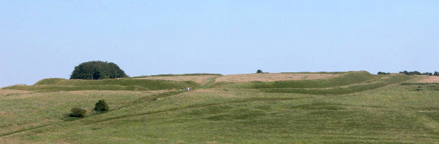
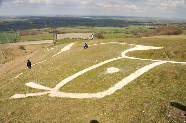
Uffington Castle is just to the north of the Ridgeway at about the same level. It has a large pay and display car park, and you access the white horse and castle across a path from here or you can continue on up the track and join the Ridgeway nearer Wayland Smithy.
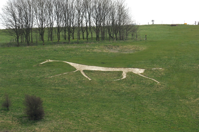
On the hillside the other side of the castle is the oldest of the white horses and unlike later works, that were just cut into the chalk, this ancient horse was constructed by cutting blocks of chalk that were sunk into their positions. Although always now referred to as a horse, it is not truly horse shaped and could have been a representation of a mystical being, god or some other.
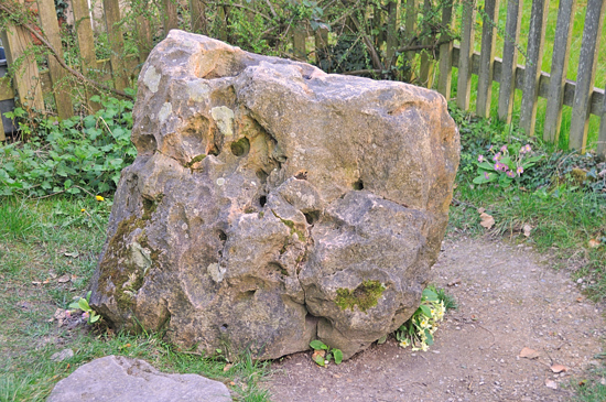
The Blowing Stone is a large rock with many holes and if you blow into one of these, as you would a bugle or trumpet, it gives a low pitch noise that can be heard for many miles. There are many legends connected with this including some linking it with several well known Kings and leaders from the distant past. It is thought to have been taken to its current location from Uffington Castle. It is now located in the front garden of a house just over 1/2 mile north of the Ridgeway down a road that the Ridgeway crosses and near the B4507. It is on the side of the road.
The next castle that we come to is shown on the Ordnance Survey map as an unnamed fort, is on the left, so just to the north of the Ridgeway, this is known as Sedgebury Camp. A road or track that joins the Ridgeway passes through the castle.
You Cross the A338 SU395843 and cross a
B road at SU418841, where there is a car park
Google aerial.
Another long barrow known as Scutchamber Knob, is by the side of the Ridgeway. There is a car park at end of lane next to it. Just before we reach this long barrow there is one of a number of places that we could, if we wished, visit Grims Ditch, discussed in more detail below.
Car park on the road off the A34 to West Illsley
at SU479840
Multimap The Ridgeway comes down into and through Goring, crossing the River Thames. For many this is the end of the Ridgeway, although not the end of the Ridgeway Path.
|
|||||||||||||||||||||||||||||||||||||||||||||||||||||||||||||||||||||||||||||||||||||||||||||||||||||||||||||||||||||||||||||||||||||||||||||||||||||||||||||||||
| Further Information
Nature Reserves on or near the Ridgeway Path
National Trails
http://www.nationaltrail.co.uk/ridgeway/
Please let us know any other information that we can add to the Grid(s) or page and any errors that you discover. Before making a long trip to any location it is always wise to double check the current information, websites like magazines may be correct at the time the information is written, but things change and it is of course impossible to double check all entries on a regular basis. If you have any good photographs that you feel would improve the illustration of this page then please let us have copies. In referring to this page it is helpful if you quote both the Page Ref and Classification from the Grids above. To print the planning grid select it then right click and print the selected area. Please submit information on locations you discover so that this system continues to grow. |
|
||||||||||||||||||||||||||||||||||||||||||||||||||||||||||||||||||||||||||||||||||||||||||||||||||||||||||||||||||||||||||||||||||||||||||||||||||||||||||||||||
. |
|||||||||||||||||||||||||||||||||||||||||||||||||||||||||||||||||||||||||||||||||||||||||||||||||||||||||||||||||||||||||||||||||||||||||||||||||||||||||||||||||
|
|||||||||||||||||||||||||||||||||||||||||||||||||||||||||||||||||||||||||||||||||||||||||||||||||||||||||||||||||||||||||||||||||||||||||||||||||||||||||||||||||
|
|
|||||||||||||||||||||||||||||||||||||||||||||||||||||||||||||||||||||||||||||||||||||||||||||||||||||||||||||||||||||||||||||||||||||||||||||||||||||||||||||||||