| Home | Newsletter | Locations | Diary |
|
Indexes |
|
|
|
|
|
|||||||||||||||||||||||||||||||||||||||||||||||||||||||||||||||
|
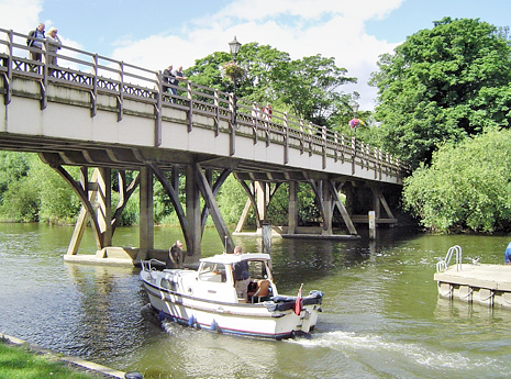
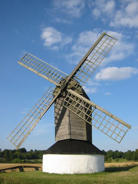
Above image is of
Goring Bridge ,
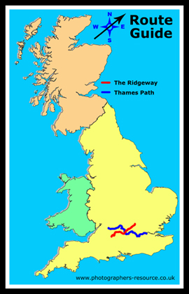
Start:
SU118680
Map Multimap
End: SP959168
Map Multimap shown in red on the map, the blue line is the Thames Path.
This route guide is in 3 parts:-
Part 3 - The River Thames to Ivinghoe Beacon
There are many ancient trackways converging on
Goring as there is a point that the River Thames was able to be forded, today you
cannot ford the Thames as the water level is kept higher to allow boats to go up to just beyond Lechlade,
using weirs to maintain the water
levels and locks to pass the boats through. The Thames Path another
National Trail,
The traditional extension to the Ridgeway was up the Icknield Way to the beacon, The Ridgeway path does not follow this, but uses a number of paths and other features that allow you to see more items while on the journey.
Watlington White Mark is a triangular mark cut out of the turf to expose the white chalk beneath on the hills south of Watlington. It is said have been created by Edward Horne, the vicar of Watlington, in 1764, who was ashamed of his spire-less church. By cutting this shape in the hills, when he looked from his upstairs vicarage window over the church, towards the Chilterns, the tower by all appearances was topped by a spire.
The path passes Tring Park and crosses the Grand Union Canal before also passing Bledlow Cross, another hillside marking in chalk.
Whiteleaf Cross - another chalk mark.
Passing through Chequers (watched by close circuit TV).
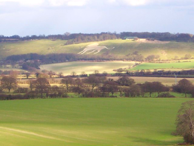
The end of the path is at the Ivinghoe Beacon, providing good views across the countryside and view of the hillside feature at Whipsnade, which is a lion cut into the chalk hillside. Although the end of the path its not quite the end of your walk as you have to walk back down off the beacon.
|
|||||||||||||||||||||||||||||||||||||||||||||||||||||||||||||||
| Further Information
Nature Reserves on or near the Ridgeway Path
National Trails
http://www.nationaltrail.co.uk/ridgeway/
Please let us know any other information that we can add to the Grid(s) or page and any errors that you discover. Before making a long trip to any location it is always wise to double check the current information, websites like magazines may be correct at the time the information is written, but things change and it is of course impossible to double check all entries on a regular basis. If you have any good photographs that you feel would improve the illustration of this page then please let us have copies. In referring to this page it is helpful if you quote both the Page Ref and Classification from the Grids above. To print the planning grid select it then right click and print the selected area. Please submit information on locations you discover so that this system continues to grow. |
|
||||||||||||||||||||||||||||||||||||||||||||||||||||||||||||||
. |
|||||||||||||||||||||||||||||||||||||||||||||||||||||||||||||||
|
|||||||||||||||||||||||||||||||||||||||||||||||||||||||||||||||
|
|
|||||||||||||||||||||||||||||||||||||||||||||||||||||||||||||||