Liddington castle
also known as Liddington Camp
Liddington, Wiltshire
|

Location Guide |
Picture by
Brian Robert
Marshall


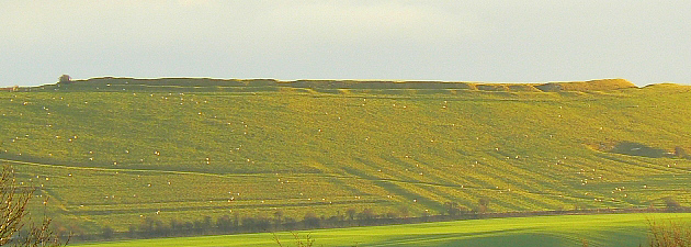
Liddington Castle is seen by many between
junction 15 and 16 of the M4, sitting at high point on the edge of the Marlborough
Downs. A little over half the size of
Barbury Castle
,
not far away, it is not visited by anything like as many people. The only
route to this castle is a mile walk along a footpath, and with no car
park or publicity, if you visit you are likely to be on your own. It is 50ft
higher than Barbury Castle and has better views over the Marlborough Downs. It used to
be famous for its views, but much of this has now been covered by Swindon, with
the Great Western Hospital being a large chunk in the foreground.
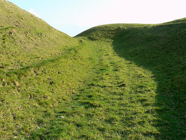
The castle is thought to have had a single
round house building in the middle, this is all that shows up on a geophysical
survey. It has a single ditch (most have at least 2) and an entrance at the
south east is defined by a few half buried Sarsen stones. Pottery from the
early Iron Age has been found here and on the northern escarpment there are some
Neolithic flint mines.
Liddington Castle was one of the earliest hill
forts in Britain, with first occupation dating to the seventh century BC. The
earthworks consist of a relatively simple oval bank of timber and earth, fronted
by a ditch, with opposing causewayed entrances on the east and west sides. The
western entrance was later blocked off and the eastern one may have been lined
with Sarsen stones. A palisade of wooden posts may have lined the top of the
bank. During a later phase the bank and ditch were improved and a rampart of
dumped chalk, excavated from the enlarged ditch, increased the height of the
bank.
Liddington Castle is sometimes suggested as a
possible site of Mount Badon and the location of the late fifth century AD
Battle of Mount Badon
in Arthurian myth. There is no archaeological evidence to indicate activity
during this later period.
Paragliding:- you will often see paragliders/hanggliders
coming off the top of this castle, for more information on paragliding here see
Thames Valley
Hang-gliding
club site.
Like Barbury it is also a site that creates
interest in crop circles, see some by
clicking here.
Please let us know any other information that we
can add to the Grid(s) or page and any errors that you discover. Before making a long trip to any location it is always
wise to double check the current information, websites like magazines may be
correct at the time the information is written, but things change and it is of
course impossible to double check all entries on a regular basis. If you have
any good photographs that you feel would improve the illustration of this page
then please let us have copies. In referring to this page it is helpful if you
quote both the Page Ref and Topic or Section references from the Grid below. To print the
planning grid select it then right click and print the selected area.
Please submit information on locations you discover so
that this system continues to grow.
|