| Home | Newsletter | Locations | Diary |
|
Indexes |
|
|
|
.
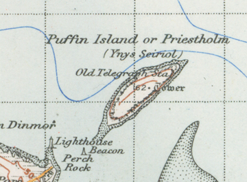
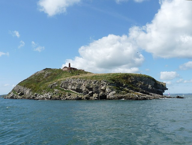
History It is said King Cadwallon ap Cadfan of Gwynedd sheltered on the island in around 630 when fleeing an invasion from Northumbria. A monastery existed on the island in the late 12th century as it is known that Llywelyn the Great issued two charters in 1221 and 1237 confirming the canons regular, in possession of the island and the church and manor of Penmon on the mainland of Anglesey. The ruins of several ecclesiastical buildings are visible on the island within an enclosure. One of these, the remains of a 12th century church tower has a pyramidal roof, which is only one of two others like it, at Penmon and Llanelian. It is said St Seiriol Gwyn (born c.494) was
given the island and established a religious community there as well as on the
mainland at Penmon, where there are the remains of
Penmon Priory
During the middle ages monks would carry pictures of saints with them in the hope to procure food and other products. The monks here used to carry images of Saint Seiriol with 9 cheeses in his arms and these would be exchanged for wood or flour, and it was supposed to bring the farmer prosperity. At one time the inhabitants of the island are said to have caught young puffins, pickle them in barrels and then send them to England to be sold.
In 1841 a semaphore telegraph station was built on the north-eastern tip of the island. Semaphore Communication System The 18th and early 19th centuries saw a tremendous increase in the trade of the Port of Liverpool, and merchants and ship owners of the port felt they needed to know, as soon as possible, when their ships may be arriving. This led to the erection of signal houses being built, the first was erected at Bidston Hill in 1763. Flag poles were also set up, from which the house flags of the ships sighted would be flown. At one time there were over a hundred of these poles extending in a line on either side of the Signal House. It was later decided to extend this method of signalling and Semaphore Stations were erected in commanding positions, in a number points along the coast of North Wales. By 1827 communication was established between Liverpool and Holyhead, a distance of seventy miles, via this method. The Semaphore Station furthest away from the base was erected on the northern slope of Holyhead Mountain, Anglesey. So others were erected at strategic points including off the Anglesey coastline. By 1841 these had become a popular form of communication, that accommodation was added for signalmen and their families. This was also the year that a Semaphore Station was built on the north-east point of Puffin Island. In all between Holyhead and Liverpool there were 12 of these stations. The most up to date type of semaphore in use at the stations consisted of two masts, each fitted with four arms, two on each side of the mast, and operated from a room below the deck upon which the masts were raised. The alphabet was represented by numbers, and the points of the compass could be given by the use of a further thirty two numbers. The men in charge of these stations became such expert signallers that a ship owner in Liverpool would often receive the information that his vessel was off Holyhead in less than a minute from the time of her number being ascertained, while the speed of the transmission was such that the first part of the message would reach Liverpool before the last part had left Holyhead. In a special test carried out in 1830 a message was sent out from Liverpool to Holyhead, and a reply received back in Liverpool in just twenty three seconds! From 1860 onwards, the old semaphore system was gradually superseded by electrical transmission and many of the intermediary stations like the one on Puffin Island were closed down. It was converted in 1887 from the Dock Board Observatory to a Biological Station, but has been in ruins since the beginning of the 20th century. Today its the only ruined building on the island along with the monastery remains that can be seen from boats that tour around the island.
Disused Semaphore Station on top
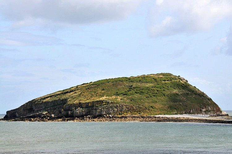
The Wildlife Today the island is better known for it's wildlife. It is a Special Protection Area, particularly because of its Great Cormorant colony of over 750 pairs, making it one of the largest colonies in the British Isles. At one time the island was heavily grazed by rabbits, but these were wiped out by an outbreak of myxomatosis around 40 years ago. Puffins, from which the island gets its name today, bred in considerable numbers at one time, with up to 2,000 pairs recorded. However during the 19th century the Brown Rat was introduced, accidentally, to the island and reduced the population to just a few pairs. In 1998 the Countryside Council for Wales started an eradication programme of the rats and the Puffin population has started to increase again. The island is also a home for thousands of guillemots and razorbills nesting on the cliffs, as well as Sandwich Terns and Eider ducks. On the far side of the island you also might glimpse grey seals. Off the coastline the strong currents provide for an abundance of marine life, particularly on the north coast where the depths reach 15 metres. Occasionally there are sightings of bottlenose dolphins and harbour porpoises in the sea. There is also one identified shipwreck, a steamship. The Pioneer with a cargo of iron bars, ran ashore in 1878, when the tow lines to it broke following its rescue from engine failure near The Skerries. A veneer of heavily guano enriched soil masks the limestone over much of the surface, leading to an impoverished vegetation dominated by a dense mat of grasses including Red Fescue and Cock's-foot, other plants include Common Nettle, Bramble, and Common Elder.
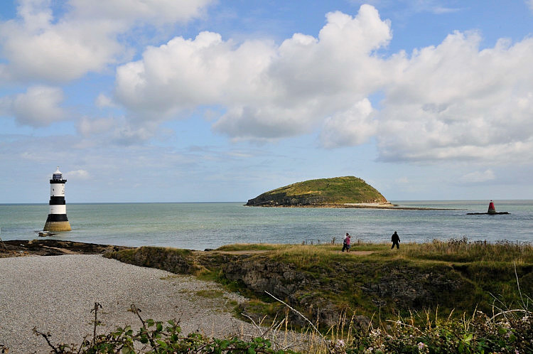
Visiting the Island The island is not accessible, it is privately owned and is a special reserve for the wildlife only. From Beaumaris Pier, between Easter and
October, you can take a boat trip with
Puffin
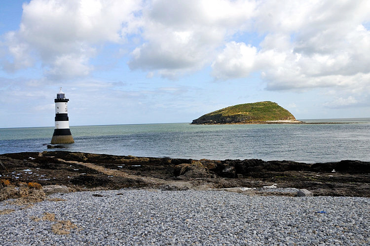
Island Boat Cruises, Alternatively for a view of the island from the mainland you can visit Penmon and it's lighthouse and get good views of it from here, as I did on my visit.
Please let us know any other information that we can add to the Grid(s) or page and any errors that you discover. Before making a long trip to any location it is always wise to double check the current information, websites like magazines may be correct at the time the information is written, but things change and it is of course impossible to double check all entries on a regular basis. If you have any good photographs that you feel would improve the illustration of this page then please let us have copies. In referring to this page it is helpful if you quote both the Page Ref and Topic or Section references from the Grid below. To print the planning grid select it then right click and print the selected area. Please submit information on locations you discover so that this system continues to grow.
|
||||||||||||||||||||||||||||||||||||||
. |
||||||||||||||||||||||||||||||||||||||
|
||||||||||||||||||||||||||||||||||||||
|
|
||||||||||||||||||||||||||||||||||||||