St Seiriols Well
Penmon, Anglesey
|

Location Guide |
| Background and the
Saint Prior to Christianity,
pagan or Celtic religions existed, and many of these were associated
with water, pools, and wells. When Christianity arrived it was their practice
to overwrap Christianity on top of the existing religion. So if there
was a stone circle in use this would become the centre of a church, and
if a well was considered sacred then this too would become the centre
piece of the new church. Many early monasteries have springs, wells or
pools underneath them including Strata Florida Abbey in Mid Wales.
This is said to be the location of a monk who
established his small home or cell next to this well, and ministered or
worshiped here. St Seiriols was a friend, and existed at the same time as St Cybi,
in the 6th century, these were Celtic Christians, not connected with the church
or Rome. They would have lived simply, baptised people and perhaps used herbal
remedies and spells to cure some people. St Cybi was at Holyhead and also had a
well and church, the later church is within the walls of the roman fort - see
Caer Gybi Roman Fort.

There is an Icon, a sort of picture, that shows
the Meeting of the Saints. In the icon the two saints are seen meeting at
the Clorach Holy Well in the centre of Anglesey. The legend is that St Cybi was
tanned facing the sun travelling East in the morning and West in the afternoon.
St. Seiriol was tanned in the opposite direction his face remained pale! Hence 'Seriol
Wyn a Chybi Felyn' White Seriol and Tawny Cybi!.
Wikipedia
 also tells a version of the same story.

|
 |
They are said to have met at Clorach
Wells in Llandyfrydog, others say a well, or a ford that was located very
near what was later to be Rhyd-y-Saint railway station
SH499758.

Seiriol was said to have been the son of Owain
Dunwyn of Rhos, an old kingdom and part later the kingdom of Gwynedd, North
Wales near Conwy, 13 of its kings are known.
Seiriol was a younger brother of King Cynlas of
Rhos and King Einion of Llŷn. His cell at Penmon is said to have been rebuilt by
his brothers, as they didn't think his humble residence was good enough.
Another variation of the story says that his
brothers did not feel the cell was befitting a prince and built the monastery
for him.
Later he is said to have retired and moved onto
Puffin Island
 nearby, where he
eventually died and was buried. In another version of the story he moved to
Puffin Island to get some piece but a number monks followed him and established
another monastery there, until he sent some or all of them back. The monastic
building ruins on
Puffin Island nearby, where he
eventually died and was buried. In another version of the story he moved to
Puffin Island to get some piece but a number monks followed him and established
another monastery there, until he sent some or all of them back. The monastic
building ruins on
Puffin Island
 are from later. are from later.
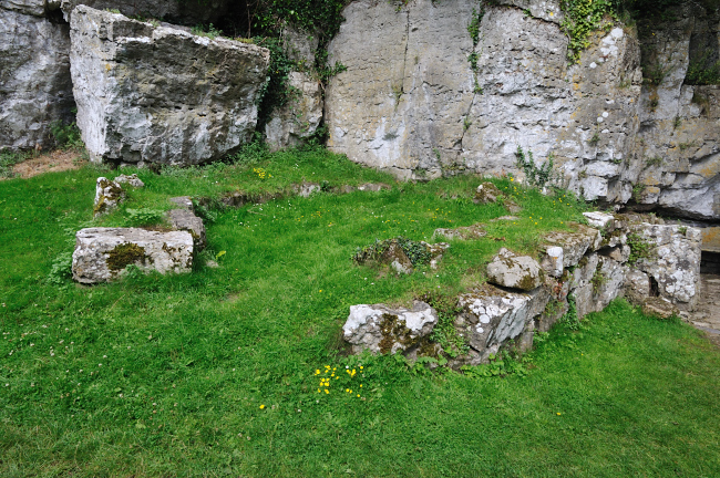 
The location of the original
cell
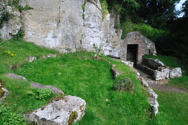 
Cell and well behind
| The Well
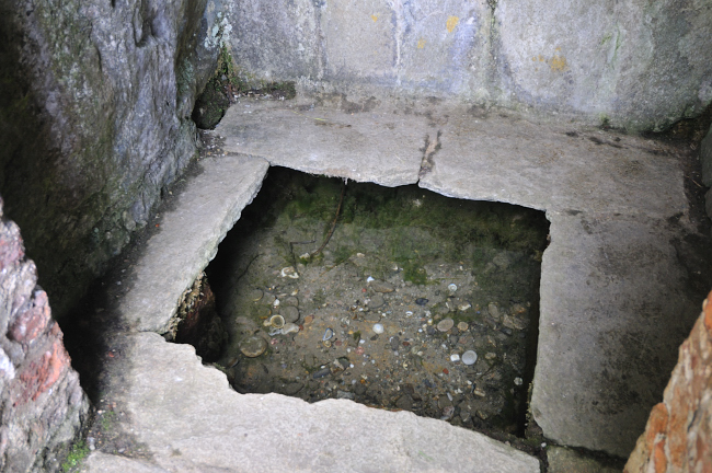
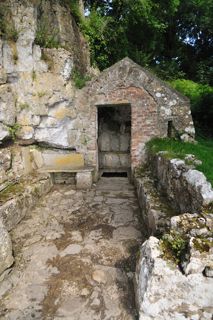
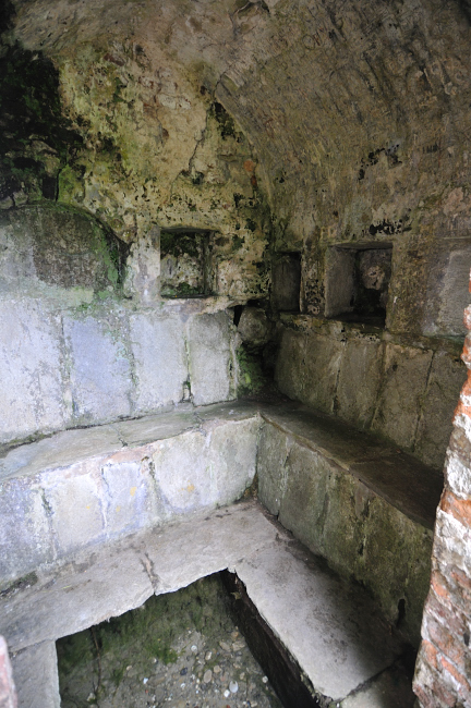
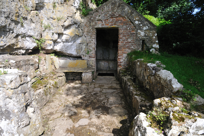
The well is a small building with most of
the floor open so that you can see shallow water below, a spring feeds
this with clear water from one side and it flows out under the ground so
that you just see a framed area of shallow very clear water.
According to the Ordnance Survey map, the
water actually originates from a spring just a little way away and then flows
through the building, this does line up with the direction of flow of the water.
Within this building there are stone benches,
recesses, and the door post shows where a lock bar or fixing used to hold a door
shut. The walls show the remains of plaster. Outside there is a courtyard that
may have been another building and next to this is the marking of where a round
hut was and said to have been the site of the original cell. This building is
not really ancient, and the upper structure is said to be largely made of brick and
date from the 18th century while some of the lower areas are older.
This spring was a healing well and accounts
into the 1800's if not later, talk of its healing properties.
The site is very quiet, and sheltered.
In more recent times I have heard that the
recreated Druidic Order has classed this also as one of their holy places.

|
 |
The
Anglesey Coastal Path
 also runs past here, so its worth stopping off to take a look.
Please let us know any other information that we
can add to the Grid(s) or page and any errors that you discover. Before making a long trip to any location it is always
wise to double check the current information, websites like magazines may be
correct at the time the information is written, but things change and it is of
course impossible to double check all entries on a regular basis. If you have
any good photographs that you feel would improve the illustration of this page
then please let us have copies. In referring to this page it is helpful if you
quote both the Page Ref and Topic or Section references from the Grid below. To print the
planning grid select it then right click and print the selected area.
Please submit information on locations you discover so
that this system continues to grow.
|