High Force
Middleton-in-Teesdale,
Durham
|

Location Guide |

 by
Paul Allison by
Paul Allison

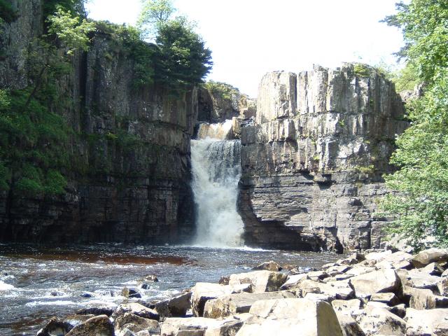
| High Force on the River Tees, is spectacular,
with a single drop of 21 meters, around 70ft, it can be viewed from the lower
river level and path approaching it, and from the higher river level up steps on
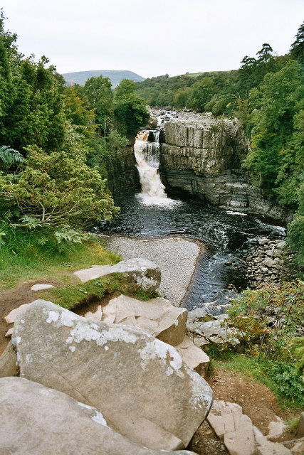
this northern side. It can also be viewed from a high position over the falls
and on the top of the falls on the southern side from a footpath which also
forms a part of the Pennine Way long distance path. You can photograph these falls from the river
level, off rocks, but you may not be able to get on these when the river is in
full flow. This is accessible off the path to the northern side of the falls,
but trees along the path stops the view much of the way. To get a higher level
view, use the access to the top of the cliffs giving a view over the falls from
the Pennine way, before you reach the top of the falls.
You can photograph the top of the falls from
either side but if you want a view down the falls from the top this is easier to
achieve from the Pennine Way path side.
In the summer months water flows through a
cutting in the rock top and this is the view you see most often of these falls,
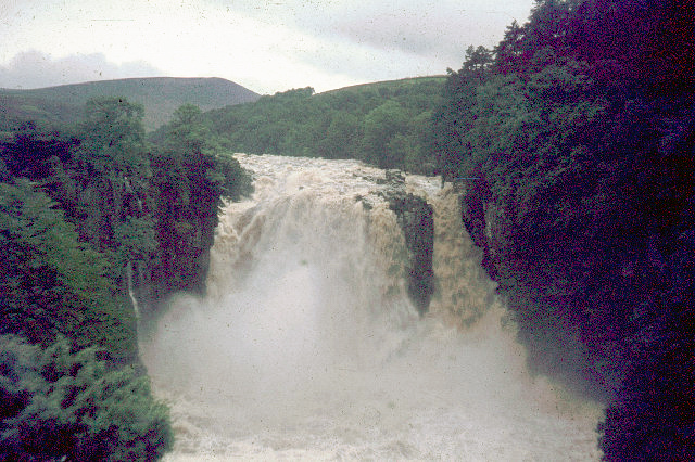
but when the flow is higher it also comes over in a second place or in much
heavier flow over the whole of the top. There is now a reservoir further up the
valley and this tends to stop excessive increases in water level.
In the past, in harsh winters, these falls have
frozen producing spectacular effects, but this rarely happens now.
It is not, as some times claimed, England's
tallest waterfall, there are several that are taller including some with a
single drop, however it is probably the most spectacular of the larger falls in
England.
|

 by
Andy Jamieson by
Andy Jamieson

|
The land and path to the north is on the estate of Raby
Castle, which is
located 20 miles to the east at Staindrop.

High Force after a storm
 by
John Thorn by
John Thorn


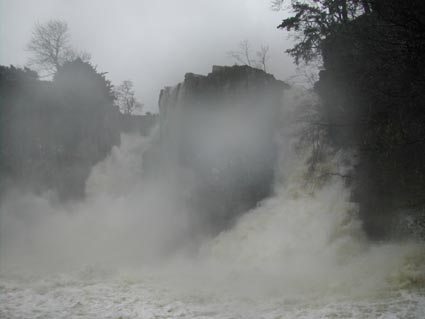
In the mist from High Force in February
 by
Les Hull by
Les Hull

|
Location: High Force, Middleton In
Teesedale, Durham |
|
Grid Reference:
NY880283 |
Ceremonial County:
Durham
 |
|
Map Link:
StreetMap

|
Aerial photo:
Google Aerial
 |
|
Getting there: On the B6277, 4.5 miles
from Middleton-in-Teesdale, Co Durham |
|
Access: Across the road from the car park is a
fairly level walk down a good path to near the bottom of the falls,
steps then go up to the top. There is no way to cross the river at the falls.
From the car park, across the road and to the
left a footpath takes you around some woods for around 1000 yards, (1/2
mile) to a substantial bridge over the river. This allows access to the
Pennine Way, and after a little climb you get up to a level where you can
see over the falls, the path goes on to and past the top of the falls. |
Website:
Own
 Raby Castle
 |
Other Useful Websites:
WiKi
 |
|
Email: teesdaleestate@rabycastle.com |
|
Address: Postal address is: Raby
Estates Office, Middleton-in-Teesdale, County Durham, (this is some miles away). |
|
Postcode: DL12 OQH |
Telephone: 01833 640209 |
|
Opening Times: All Year Round |
|
Charges: to north of falls, along path:
Easter to end of October Adults £1.50; child (under 16) free; Concessions £1 (tickets from car park).
At other times an honesty box is in operation.
Viewing from south of falls over bridge and on
footpath: FREE
Parking Charges by entry to path to northern side. Car £2; Motorcycles £1.50 |
|
Nearby Locations: Pennine Way, Low Force,
White Force |
|
Other Location Pages:
Waterfall
 Waterfalls of Durham

|
|
Notes: May be closed during adverse weather
conditions
In the car park there is a Gift Shop
(Easter-October) and toilets.
|
|

|
Please let us know any other information that we
can add to the Grid(s) or page and any errors that you discover. Before making a long trip to any location it is always
wise to double check the current information, websites like magazines may be
correct at the time the information is written, but things change and it is of
course impossible to double check all entries on a regular basis. If you have
any good photographs that you feel would improve the illustration of this page
then please let us have copies. In referring to this page it is helpful if you
quote both the Page Ref and Topic or Section references from the Grid below. To print the
planning grid select it then right click and print the selected area.
Please submit information on locations you discover so
that this system continues to grow.
|