| Home | Newsletter | Locations | Diary |
|
Indexes |
|
|
|
|
|
The falls border Kintail, donated to the National Trust for Scotland in 1944 and subsequently incorporating West Affric in 1993.
Walking Route You need Ordnance Survey Explorer no 414, or to have printed out all the areas around the route from the internet. Plus someone who is good at reading maps. You need to be equipped and confident at hill walking. Start from the Forestry Commission car
park, Dorusduain NG977222
StreetMap
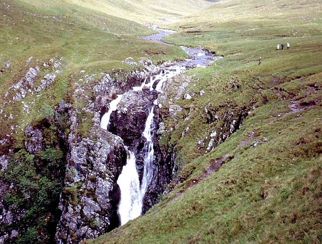
To get to the car park:- Turn off the A87 at Morvich, and just north of the Croe bridge take the private minor road up Strath Croe (Ignore the sign indicating the Falls of Glomach car park which does not indicate this road and makes for a longer walk). The road passes Lienassie Farm and has a height restriction before reaching the Forestry Commission car park at the end of the road. There is a sign in the car park indicating 'Falls of Glomach - 4 miles', follow the track which slopes uphill slightly from here. Keep right where another track leads off left and continue up the valley. Soon another track joins in from the right. Further on the track forks, take the right fork and cross the bridge. Near the top of the plantation, cross back over the river and follow the clear path which heads off uphill out of the forest. The excellent stalkers path now heads uphill, keeping to the left side of the valley above the river. At the head of the valley the path climbs out and crosses the bare bealach with good views. Continue on the path, which undulates for a while. A sign before the gorge indicates that it is dangerous to proceed further, but most visitors will continue very carefully down to a peer down ledge which has a terrific view of the great falls, where the Allt a' Ghlomaich tumbles in two great leaps down into an awesome gorge. To return to Strath Croe, retrace your steps.
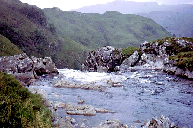
Stream above and top of
the falls.
Please let us know any other information that we can add to the Grid(s) or page and any errors that you discover. Before making a long trip to any location it is always wise to double check the current information, websites like magazines may be correct at the time the information is written, but things change and it is of course impossible to double check all entries on a regular basis. If you have any good photographs that you feel would improve the illustration of this page then please let us have copies. In referring to this page it is helpful if you quote both the Page Ref and Topic or Section references from the Grid below. To print the planning grid select it then right click and print the selected area. Please submit information on locations you discover so that this system continues to grow.
|
||||||||||||||||||||||||||||||||||||||||||
|
||||||||||||||||||||||||||||||||||||||||||
.
|
||||||||||||||||||||||||||||||||||||||||||
|
|
||||||||||||||||||||||||||||||||||||||||||