Duntisbourne Wet Lane
Duntisbourne Abbots, Gloucestershire
|

Location Guide |
The River Dunt runs through a group of villages
and hamlets known as 'The Dunitsbournes' and at various points where the road
crosses the river there are Fords, and along a road which connects two
of them is a Wet Lane.
|
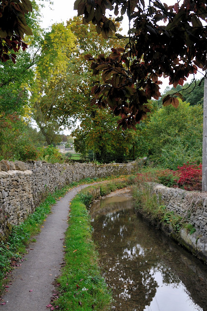
 The
Wet Lane facing towards Duntisbourne Abbots The
Wet Lane facing towards Duntisbourne Abbots
|
The Duntisbourne Wet Lane is on a single track
road that connects Duntisbourne Abbots with Duntisbourne Leer. It is not
suitable for motor vehicles as a through route and is not the main road today
that links the two
places together.
Duntisbourne Abbots village is the largest community amongst
the group. It is situated on a hill and at it's centre is the parish church. It
has exquisite Cotswold houses, narrow lanes, a beautiful little church and a
number of nearby fords and the wet lane.
To get to the village you take the exit off
the A417 for 'The Duntisbournes' when you come to a fork in the road, take the right
fork to get to the village. The roads in this area are single track so to
see the wet lane I would suggest you park up in the village and then walk down
the lane. Parking is limited but there is usually space in front of the small
village hall at the top of the village, and a Car Park sign takes you to a small
parking area behind the village hall. It is downhill to the Wet Lane from here.
It is not advisable to drive through the
section of wet lane as you can see from the picture it is very narrow. However
because the Wet Lane is almost in the centre section of the road, it is possible
to drive part way down from the Abbots end and if your vehicle is not too large
you can park up on a section of grass verge and walk the rest of the way. When you get to the section of the road that is the Wet Lane there is a raised footpath which runs the length of it, and at the
other end you come into Duntisbourne Leer, which has it's own ford, probably the
most photographed Ford in the area. See our location guide
Duntisbourne Leer Ford, for more details and pictures.
|
If you are approaching from Duntisbourne Leer,
after photographing it's ford, once you have crossed the ford you take a sharp left turn and
start to rise again, there is a road on your right which says 'not suitable for
motor vehicles' as shown in the picture below, and this is where you will find the Wet Lane.
This is a beautiful part of the
Cotswolds, and all the Duntisbournes should be visited if you are in the
area.
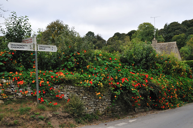 
The Sign at Duntisbourne Leer
- signifying the start of the Wet Lane
  |
  |
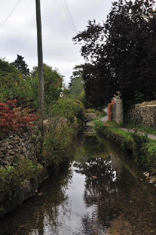
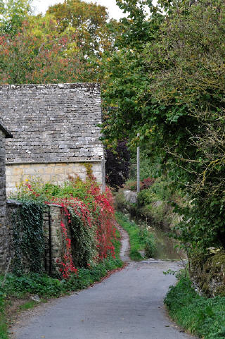
 Wet
Lane from Duntisbourne Leer end Wet
Lane from Duntisbourne Leer end |
 Facing
towards Duntisbourne Leer Facing
towards Duntisbourne Leer |
  |
  |
 About
half way along the Wet Lane About
half way along the Wet Lane |
 Approaching
the Ford from Duntisbourne Leer Approaching
the Ford from Duntisbourne Leer |
|
Location: The Wet Lane, Duntisbourne
Abbots, nr Cirencester, Gloucestershire |
|
Grid Reference:
SO973077 |
Ceremonial County:
Gloucestershire |
|
Map Link:
Multimap
 StreetMap

|
Aerial photo:
Multimap Aerial
 |
|
Getting there: From the A417 take the exit to
'The Duntisbournes' and follow the signs to Duntisbourne Abbots, along a
single track road. |
|
Access: Park up in the village and walk down
the 'not suitable for motor vehicles' lane towards Duntisbourne Leer. |
|
Website: |
|
Other Useful Websites: |
|
Email: |
|
Address: |
|
Postcode: |
Telephone: |
|
Opening Times: All year |
|
Charges: None |
Nearby Locations:
Middle Duntisbourne Ford,
 Duntisbourne Leer Ford
 |
|
Other Location Pages: |
|
Other Relevant Pages: |
|
Notes:
|
|

|
Please let us know any other information that we
can add to the Grid(s) or page and any errors that you discover. Before making a long trip to any location it is always
wise to double check the current information, websites like magazines may be
correct at the time the information is written, but things change and it is of
course impossible to double check all entries on a regular basis. If you have
any good photographs that you feel would improve the illustration of this page
then please let us have copies. In referring to this page it is helpful if you
quote both the Page Ref and Topic or Section references from the Grid below. To print the
planning grid select it then right click and print the selected area.
Please submit information on locations you discover so
that this system continues to grow.
|