King Alfred's Tower
also known as Stourton Tower
Brewham, Somerset
|

Location Guide |

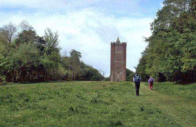
Picture by
Chris Heaton


| The tower made of about a
million bricks, is 49m (160ft) high, and is triangular in plan, with
round projections at each of the three corners. One of these, furthest
from the entrance door, has a spiral staircase within it by which
visitors can climb the 205 steps to the top, where there is a platform
with a crenellated parapet. The staircase is not well illuminated, with
only ten small openings to admit a little daylight. The centre of the
tower is hollow and open to the elements, in recent years a mesh has
been placed over the opening at the top to prevent birds from entering
the tower. The total girth of the tower is approximately 51m (168ft),
which means that the tower's circumference and height are about the
same. It is said that when
originally built, the tower stood at the union of the boundaries of the
counties of Somerset, Wiltshire, and Dorset, with one corner of the
triangular base in each county and that in more recent times the Dorset
boundary was moved so that the tower now just straddles the
Wiltshire-Somerset border.
The project to build the tower was
conceived in 1762 by the banker Henry Hoare II (1705-1785), owner of
Stourhead and creator of its famous garden, known to his family as 'the
Magnificent'. The tower was intended to commemorate the end of the
Seven Years War against France and the accession of King George III, and
supposedly stands near the location of 'Egbert's stone' where it is
believed that Alfred the Great, King of Wessex, rallied the Saxons in
May 878 before the important Battle of Ethandun (now Edington,
south-east of Trowbridge) where the Danish army was defeated. |

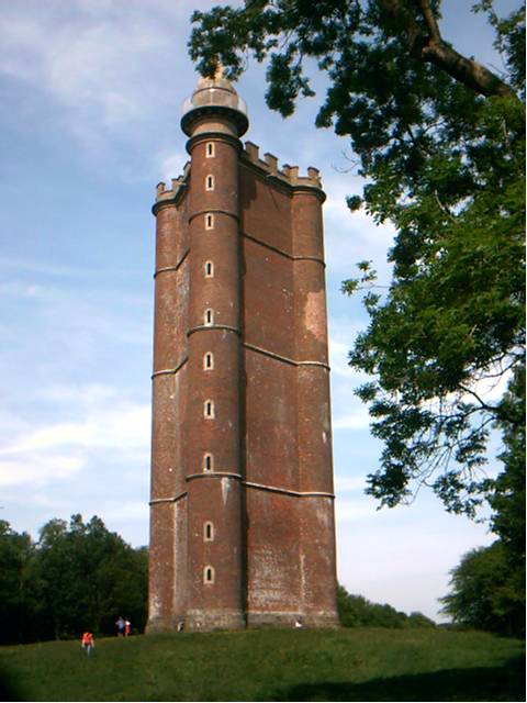
The
west side Photo by
J Tucker


To see another image similar click here
 |

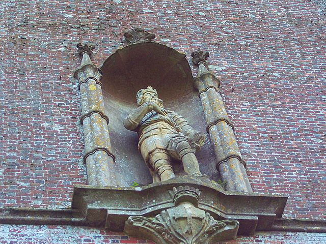
Statue of King Alfred on the tower
Photo by
Trish Steel 

The stone tablet above the door on the east
face of the tower reads:
- "ALFRED THE GREAT
- AD 879 on this Summit
- Erected his Standard
- Against Danish Invaders
- To him We owe The Origin of Juries
- The Establishment of a Militia
- The Creation of a Naval Force
- ALFRED The Light of a Benighted Age
- Was a Philosopher and a Christian
- The Father of his People
- The Founder of the English
- MONARCHY and LIBERTY"
There are very good views from the top.
|
Location:
King
Alfred's Tower, Brewham, Somerset |
|
Grid Reference:
ST745351 |
Ceremonial County:
Somerset |
|
Map Link:
OS getamap

multimap
 |
Aerial photo:
multimap
 |
|
Getting there: On the Stourhead estate, see map. |
|
Access: To the outside is at any time,
inside only when open. |
Website:
NT page
 |
|
Other Useful Websites:
Website on the tower

Wiki
 Folly Towers

|
Email:
stourhead@nationaltrust.org.uk
 |
|
Address: Stourhead Estate Office, Stourton,
Warminster, Wiltshire |
|
Postcode: BA12 6QD |
Telephone: 01747 841152 |
|
Opening Times: Inside 15 Mar–2 Nov 08
11:30-4:30 every day. Outside can be
seen at any time |
|
Charges: Inside £2.60 (£2.20), child £1.40
(£1.20), family £6 (£5.40). Groups (£2.30)
Outside Free |
Nearby Locations:
Stourhead
 estate, (this is a part of)
NT Stourhead estate, (this is a part of)
NT Stourhead
 |
Other Location Pages:
List of Follies in
the UK
 |
|
Notes:
|
|
Page Ref: King_Alfred's_Tower |
Classification:
Follies |
Date Updated: 10/2008 |
|

|
Please let us know any other information that we
can add to the Grid(s) or page and any errors that you discover. Before making a long trip to any location it is always
wise to double check the current information, websites like magazines may be
correct at the time the information is written, but things change and it is of
course impossible to double check all entries on a regular basis. If you have
any good photographs that you feel would improve the illustration of this page
then please let us have copies. In referring to this page it is helpful if you
quote both the Page Ref and Classification from the Grids above. To print the
planning grid select it then right click and print the selected area.
Please submit information on locations you discover so
that this system continues to grow.
|