| Home | Newsletter | Locations | Diary |
| Indexes |
|
| Travellers Resource |
|
|
|
|
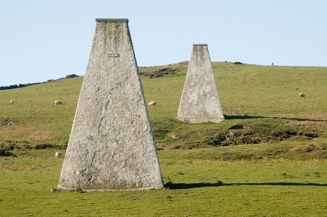
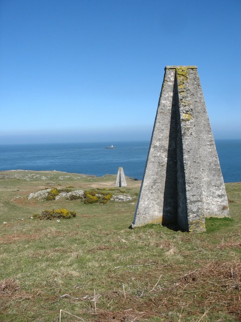
The two white ladies are in fact 3, 45ft tall markers in a line, two on the cliff top near Carmel Head, and the third on the small island of West Mouse. They point to the coal rock, a sea level rock further out than the small island of West Mouse. Coal rock can just be seen on the lowest tides and is 1.5 miles offshore. There are also two other rocks in the area, all marked with black buoys.
View from the Sea
Rear View, notice also the third marker on the island of
West Mouse
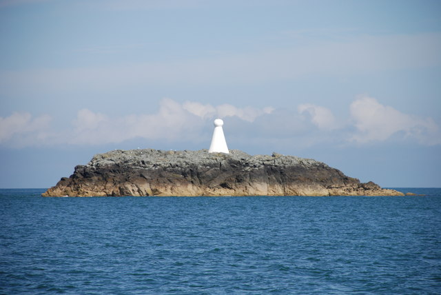
West Mouse in welsh its Maen y Bugael
The West Mouse marker up close looks like a chess pawn so similar to the other two but with a round head on top.
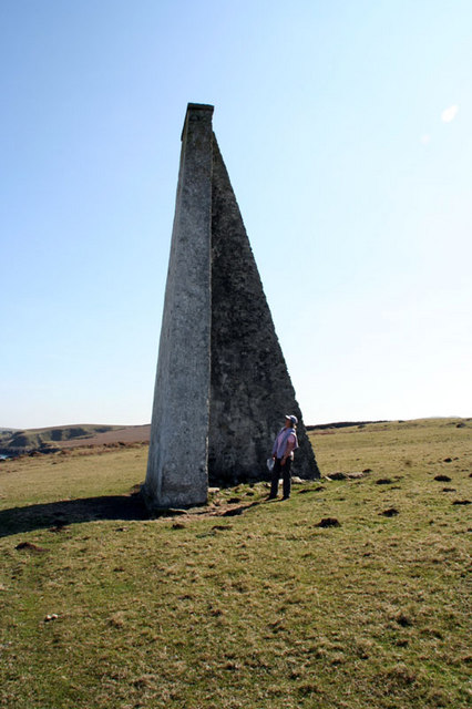
Putting a person in the photo
gives a better idea of it size The History The actual history of these markers is not clear, its said that the Mersey Harbour Board built these in the 1860's, but another person found them marked in an Ordnance Survey map of about 1840, that was a 1inch to 1 mile First edition. Some others say they were also used in the Second World War for aircraft navigation. Whenever they were built their function is clear, to point to a hazardous group of rocks, that are usually just below the surface of the water around 1.5 miles offshore. Carmel Head (Trwyn
y Gader) is at the extreme north west tip of Wales on the Isle of Anglesey. Offshore are The Skerries (Ynysoedd y Moelrhoniaid)
guarded by the
Skerries Lighthouse,
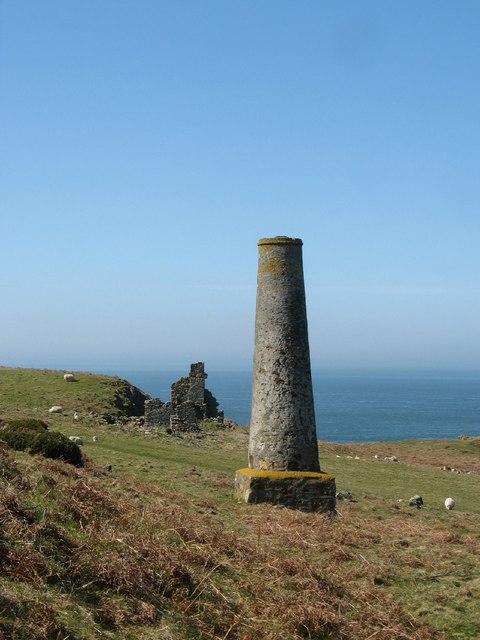
The three white ladies markers, 2 on the headland and 1 on West Mouse, are also known as the Coal Rock Beacons. The sight-line through them and the West Mouse Beacon aligns with the dangerous Coal Rock, which is awash at low water spring tides. This lies a little further offshore beyond the Mouse. Coal Rock is the centremost of a group of three, Ethel Rock to the west and Archdeacon Rock to the east. Coal Rock is a hazard to navigation as it lies sufficiently far offshore (one and a half miles) to constitute a danger to vessels making a passage to or from the Point Lynas/Amlwch direction and passing outside (to the north of) the Skerries. This was particularly so in the days of sail when coastal traffic was intense and the need to tack against adverse winds made diversion from a direct course necessary. Nearby on the headland is the remains of a copper mine from the late 18th and early 19th century.
The
Anglesey Coastal Path
Please let us know any other information that we can add to the Grid(s) or page and any errors that you discover. Before making a long trip to any location it is always wise to double check the current information, websites like magazines may be correct at the time the information is written, but things change and it is of course impossible to double check all entries on a regular basis. If you have any good photographs that you feel would improve the illustration of this page then please let us have copies. In referring to this page it is helpful if you quote both the Page Ref and Topic or Section references from the Grid below. To print the planning grid select it then right click and print the selected area. Please submit information on locations you discover so that this system continues to grow.
|
||||||||||||||||||||||||||||||||||||
. |
||||||||||||||||||||||||||||||||||||
|
||||||||||||||||||||||||||||||||||||
|
|
||||||||||||||||||||||||||||||||||||