Great Witcombe Roman Villa
nr Gloucester, Gloucestershire
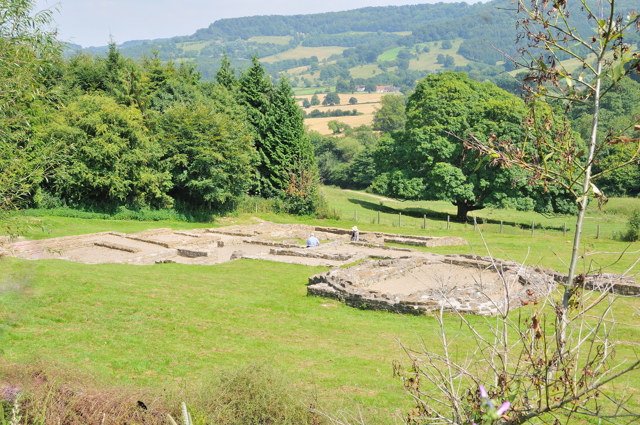
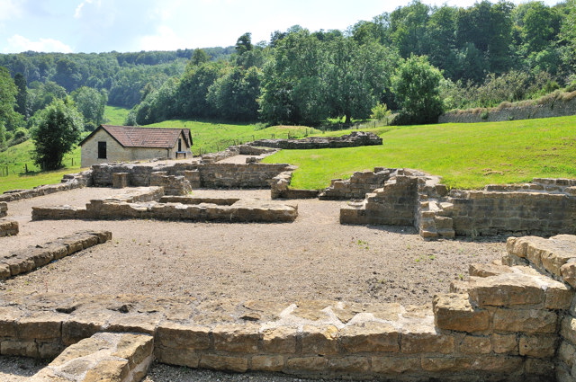
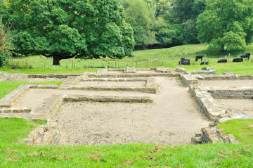
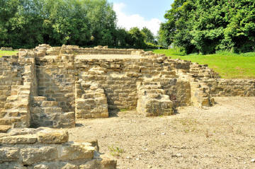
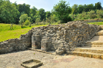
The remains of a large villa built around 250AD
with a bathhouse complex and possibly a water spirit shrine which was built on
the side of a hill. This 3rd century villa was large and extravagant built
around three sides of a courtyard.
It is thought that the villa at Witcombe formed
the centre of a noblemans country estate and was approached through formal
gardens which made use of natural springs breaking through the ground. Its
position to the Roman town of Glevum (Gloucester) meant it was able to take
advantage of the luxury goods on offer in return for agricultural produce.
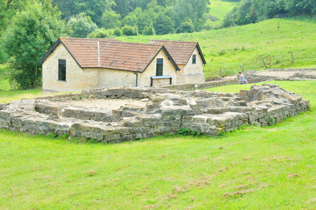
Not much is know about the villa itself and is
is believed the main family house was connected by a long gallery, which
incorporated a dining room, to a leisure complex of exercise rooms and heated
baths. Later in the 4th century it was radically modified and the dining room
was rebuilt as an octagonal plan with a round projection on one side being home
to a statue, at the same time it is believed the kitchen arrangements were also
modified.
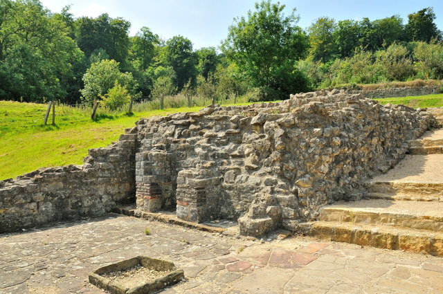
Further down the slope it is thought a great
barn was added to accommodate the farm-workers and the leisure complex was
extended to include another set of baths for the workers to use. It was finally
abandoned some time in the 5th century.
 |
 |
 For all the images here - click on the image to
see a larger version.
For all the images here - click on the image to
see a larger version. |
 |
 |
Managed by English Heritage today - although FREE access to all.
.
Planning Grid
|
Location: |
Great Witcombe Roman
Villa, nr Gloucester Gloucestershire |
|
Grid Reference: |
SO899138 |
|
Getting there: |
Located 5 miles SE of
Gloucester off A46; take the road towards Birdlip and then signposted down
narrow lane on the right.
1⁄2 mile S of reservoir in Witcombe Park; 400 metres (440 yards) from
Cotswold Way National Trail |
|
Access: |
Down a very long single
track road - through a farm yard and on to a parking area. 300 metres from
here you have to walk uphill along a drive at the top there is a gate on the
left which gives access to the site on a hillside. |
|
Parking: |
Free small car park. No
parking in the lane or beyond the car park. |
|
Facilities: |
None |
|
Things To Do,
See and Photograph: |
Villa remains, may be
cattle and horses in the nearby fields, woods, and a large reservoir in the
valley below. |
|
What to take: |
|
|
Nature highlights: |
butterflies at the
right time of year |
|
Address: |
|
|
Postcode: |
GL4 8 |
|
Telephone: |
|
|
Opening times: |
Any reasonable daylight
hours |
|
Charges: |
FREE |
|
Photo Restrictions: |
|
|
Other Restrictions: |
|
|
Special Needs Access: |
Difficult for wheelchair users as its on grass and on a hillside. |
|
Special Needs Facilities: |
None |
|
Children Facilities: |
none specific but they can run about freely |
|
Dogs Allowed: |
Yes - must be kept on leads as live stock in nearby fields |
|
CIN Page Ref: |
Great_Witcombe |
Date Updated: 07/2008 |
|

|
Please let us know any other information that we
can add to the Further information and Planning Grids or page and any errors that you discover. Before making a long trip to any location it is always
wise to double check the current information, websites like magazines may be
correct at the time the information is written, but things change and it is of
course impossible to double check all entries on a regular basis. If you have
any good photographs that you feel would improve the illustration of this page
then please let us have copies. In referring to this page it is helpful if you
quote the CIN Page Ref at the bottom of the Planning Grid above. To print the
planning grid select it then right click and print the selected area.
Please submit information on locations you discover so
that this system continues to grow.
|