Hoy High Lighthouse
Isle of Graemsay, Orkney Isles
|

Location Guide |
Hoy High Lighthouse
 Photo by
Richard Harvey
Photo by
Richard Harvey

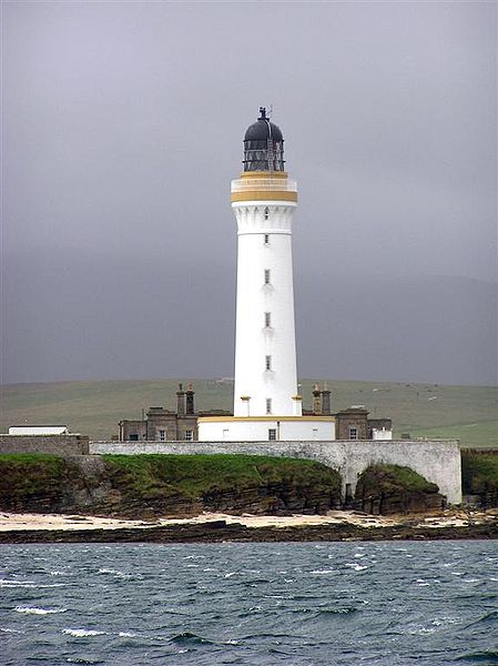
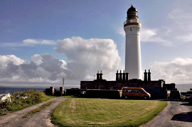
This lighthouse is on the Isle of Graemsay in
the Orkney Isles. It
marks the main channel into the Scapa Flow harbour, and along with other lights
in the area, known as range lights, they aid navigation through Hoy Sound.
This lighthouse is located on the northeast
point of the island. It was built in 1851 by Alan Stevenson, together with a
keepers residence.
In the same year a second light,
Hoy Low Light,
was built on the north point of the island about 1.4 miles west of this
lighthouse. The Hoy Low also has a lighthouse and a 1 storey keepers residence,
which was fortified during World War II and is now in private ownership.
You can reach Graemsay on the passenger-only ferry that
sails from Stromness pier to Moaness, calling at Graemsay. Once on the
island there is a walk of about 1 mile roundtrip to visit the lighthouse.
Hoy High Lighthouse
Photo by John
Brown
Lighthouse information Grid
|
Name: |
Hoy High Lighthouse, Isle of Graemsay, Orkney Isles |
|
Current status: |
Working |
|
Geographic Position: |
58°
56" 8' -3° 16" 21' |
|
Grid Reference: |
HY267061 |
|
Ceremonial County: |
Orkney Isles
 |
|
Appearance: |
round stone tower with lantern and gallery, painted white, lantern painted
black. 1 storey keeper's houses and other buildings enclosed by a stone
wall. |
|
Map
Link: |
Multimap
|
|
Aerial photo: |
Marinas.com
Hoy Low Lighthouse
|
|
Other photos: |
Geograph
photo
|
|
Originally built: |
1851 |
|
Current lighthouse built: |
|
|
Height of Tower: |
33
metres |
|
Height of light above mean sea level: |
35
metres |
|
Character of light: |
Occulting white/red every 8 seconds, |
|
Character of fog signal: |
|
|
Range of light: |
visible for 20 (white) and 16 (red) nautical miles. |
|
Owned / run by: |
Northern
Lighthouse Board

|
|
Getting there: |
Passenger ferry from Stromness Pier to Moaness, calling at Graemsay. |
|
Access: |
Tower closed. Site open with prior permission so that they know someone is
coming to have a look around. |
|
Website: |
|
|
Telephone: |
07884 017426 and speak to Mick about access to
the Lighthouse. |
|
Email: |
pr@graemsay.org.uk |
|
Other Useful Websites: |
www.graemsay.org.uk
|
| Routes: |
|
|
Other Relevant pages: |
For more articles, lists and other information
see the
Lighthouses Section
Lighthouse Map of Scotland


Featured List of lighthouses - Scotland

List of minor lighthouses and lights - Scotland
|
|
Notes: |
|
|

|
Please let us know any other information that we
can add to the Grid or page and any errors that you discover. Before making a long trip to any location it is always
wise to double check the current information, websites like magazines may be
correct at the time the information is written, but things change and it is of
course impossible to double check all entries on a regular basis. If you have
any good photographs that you feel would improve the illustration of this page
then please let us have copies. In referring to this page it is helpful if you
quote both the Page Ref and Topic or Section references from the Grid below. To print the
planning grid select it then right click and print the selected area.
Please submit information on locations you discover so
that this system continues to grow.
|