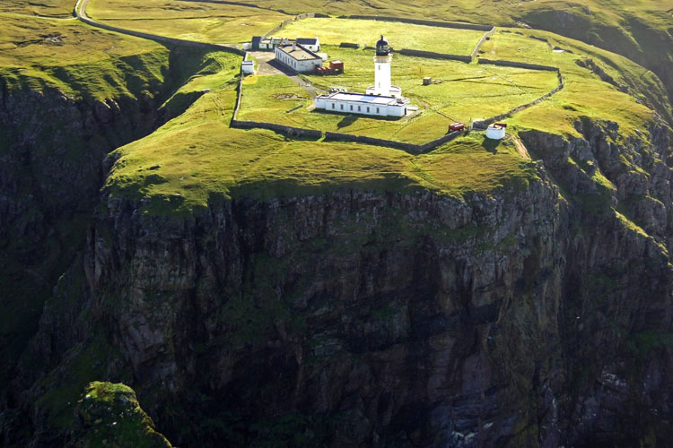
Cape Wrath Lighthouse
Sutherland
|

Location Guide |

Aerial Photo
Marinas.com
 (more images available) (more images available)
The name of the headland where
this lighthouse stands, Cape Wrath, comes not from the stormy waters of the
area but from the Norse word for a "turning point", for here the Norsemen
turned their ships to head home. This lighthouse marks the north western tip of
the Scottish mainland, 11 miles from Durness village. To get to the cape you
have to first take a ferry from Keoldale across the Kyle of Durness which takes
around 15 minutes, and then there is an optional minibus which takes you to the
Lighthouse, this takes about 30 minutes each way, and is around 2.5 hours in
total.
It dates from 1828,
was built by Robert Stevenson, and stands over 121 metres above mean sea level
and is situated on cliffs facing the Atlantic Ocean. The buildings,
surrounded by a high wall, are extensive and include the lighthouse tower built of hand dressed stone and the rest of the building is constructed of
large blocks of granite quarried from Clash Carnoch. A keepers house and a
one storey signal station, from
around the 1930s, is adjacent to the light station.
It was manned until 1998. The duties of the lightkeeper not only involved
looking after the light, but they also had to do most of the maintenance
work on the station as well.
In January 1977 the helicopter
carried out the what was called the 'Cape Wrath Relief' - a history making
moment as this was the first helicopter relief carried out at a shore-based
Scottish lighthouse.
The keeper's house is now occupied by resident
caretakers, who opened a café for visitors in 2009.
Much of the surrounding area is set aside for
military training, and public access is tightly controlled. However, guided
tours are available from Durness via minibus over a rough road for 11 miles.
|
Lighthouse information Grid
|

|
Please let us know any other information that we
can add to the Grid or page and any errors that you discover. Before making a long trip to any location it is always
wise to double check the current information, websites like magazines may be
correct at the time the information is written, but things change and it is of
course impossible to double check all entries on a regular basis. If you have
any good photographs that you feel would improve the illustration of this page
then please let us have copies. In referring to this page it is helpful if you
quote both the Page Ref and Topic or Section references from the Grid below. To print the
planning grid select it then right click and print the selected area.
Please submit information on locations you discover so
that this system continues to grow.
|