Bass Rock Lighthouse
East Lothian
|

Location Guide |

Aerial Photo
Marinas.com
 (more images available) (more images available)
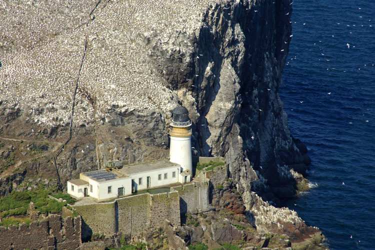
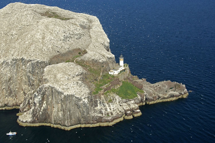
Bass Rock is located about 3 miles north east
of North Berwick, and is a steep crag on the southern entrance to the Firth of
Forth, rising about 350ft above the sea. It is an important nesting ground for
seabirds, especially gannets.
Bass Rock is about a mile in circumference. Through the
Rock, from the East to West, runs a natural tunnel, but this is not accessible
except at low tide. Half way up the rock stands the ruins of a pre-reformation
chapel which was consecrated in 1542. It has a long and varied history and is
mentioned in writings dating back to around 1316. In 1671 Charles I claimed
it as Royal property and later the fortress/castle was turned into a
prison, by 1700 however after a number of attempts to claim it by others the
fortress was demolished. In 1706 it was sold to Sir Hugh Dalrymple and his
descendants still own it today. From 1706 up to the 1st World War it continued
to be let out to tenants who earned money by fishing, grazing sheep and making
use of the seabirds.
The lighthouse was established in 1901 and is
still active today. It was build by David Stevenson, who demolished a 13th
century keep, or governors house and some other buildings within the castle to
be able to use the stone to build it. It was automated and demanned in 1988 and is
now remotely
monitored from Edinburgh.
Today the true residents of the island are the
seabirds and it is the breeding ground for 30-40,000 gannets. The best way
to see the birds and lighthouse is on one of the cruises from the
Scottish Seabird Centre
 in
North Berwick. in
North Berwick.

Aerial Photo
Marinas.com
 (more images available) (more images available)
|
Lighthouse information Grid
|

|
Please let us know any other information that we
can add to the Grid or page and any errors that you discover. Before making a long trip to any location it is always
wise to double check the current information, websites like magazines may be
correct at the time the information is written, but things change and it is of
course impossible to double check all entries on a regular basis. If you have
any good photographs that you feel would improve the illustration of this page
then please let us have copies. In referring to this page it is helpful if you
quote both the Page Ref and Topic or Section references from the Grid below. To print the
planning grid select it then right click and print the selected area.
Please submit information on locations you discover so
that this system continues to grow.
|