| Home | Newsletter | Locations | Diary |
| Indexes |
|
| Travellers Resource |
|
|
|
|
|
Maps |
|
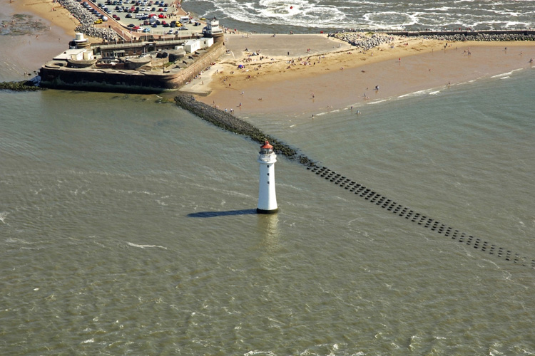
Aerial photo by
Marinas.com
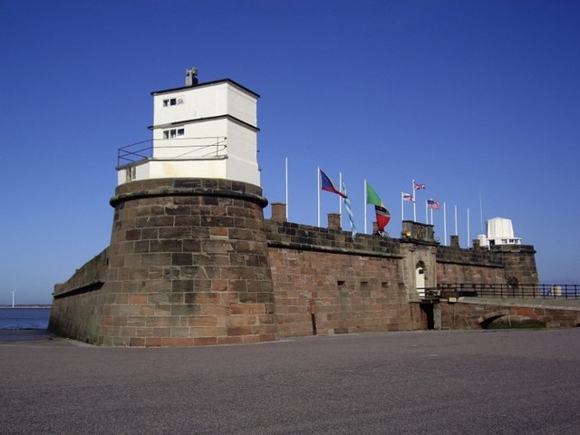
Morse code signal tower
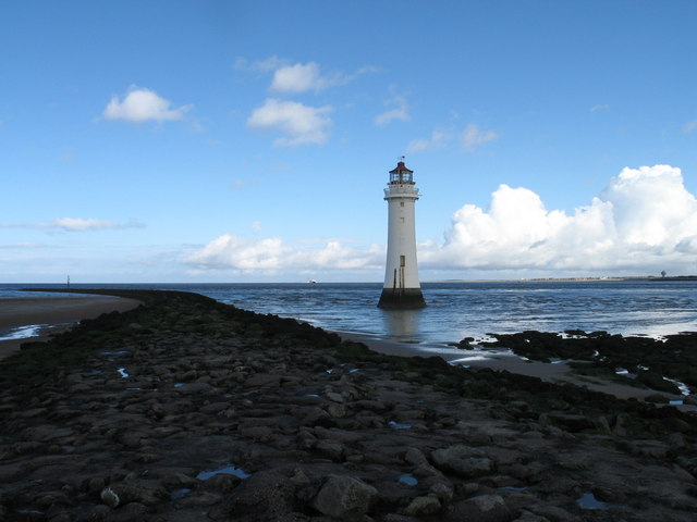
This view is from New Brighton beach, along a stone groin (foreground)
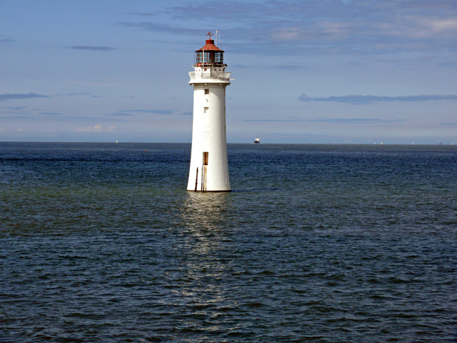
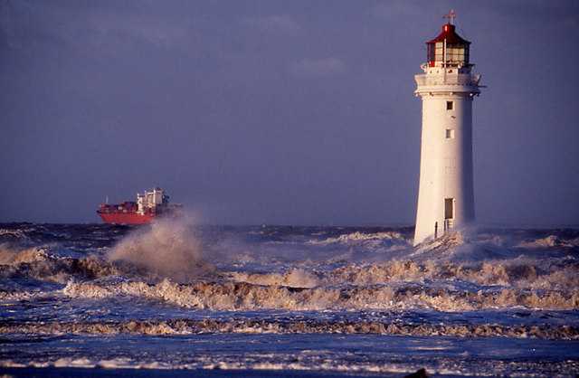
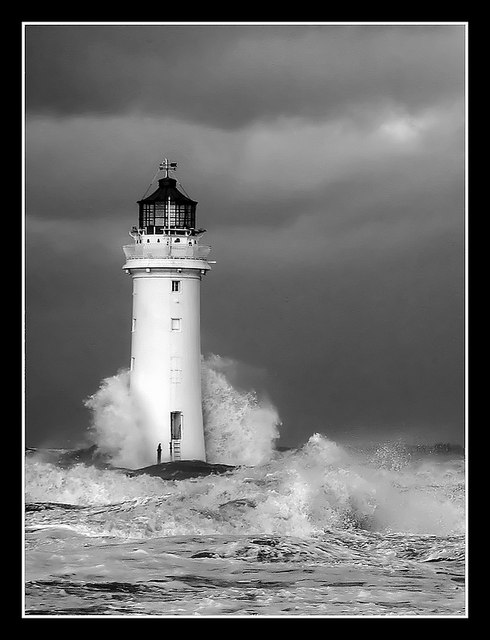
New Brighton Lighthouse, originally known as Perch Rock Lighthouse after the navigation hazard that it marks, came into operation in 1830 and continued as a navigation beacon until 1st October 1973, when it became a victim of modern navigation technology. The tower rises 90ft above the rock, the first half of which is solid. To gain access when the tide is out a ladder is needed to reach the first of the 15 iron rungs built in to the side of the tower that lead up to the door. A spiral staircase leads to the keepers' accommodation consisting of a galley/kitchen, a bathroom, a living room and a bedroom and then up to the lamp room.
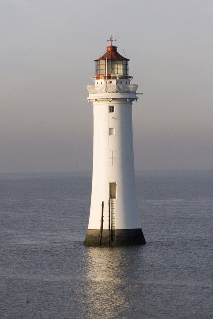
Perch Rock Lighthouse, situated
where the river Mersey merges into Liverpool Bay. It sits on a rock that was
previously called Black Rock which in 1683 had a 'perch' erected on it by the
city of Liverpool to try to stop ships from floundering upon it. On 8th June
1827 construction started with the foundation stone being laid by the then Mayor
of Liverpool, Thomas Littledale. Using a similar design to the
Eddystone
Lighthouse,
The lighthouse foundation was laid on 8th June 1827.
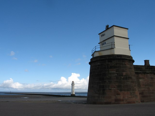
View from near boating lake
showing lighthouse and part of the fort
Fort Perch Rock, New Brighton
New Brighton had the tallest
tower
Please let us know any other information that we can add to the Grid or page and any errors that you discover. Before making a long trip to any location it is always wise to double check the current information, websites like magazines may be correct at the time the information is written, but things change and it is of course impossible to double check all entries on a regular basis. If you have any good photographs that you feel would improve the illustration of this page then please let us have copies. In referring to this page it is helpful if you quote both the Page Ref and Topic or Section references from the Grid below. To print the planning grid select it then right click and print the selected area. Please submit information on locations you discover so that this system continues to grow.
|
||||||||||||||||||||||||||||||||||||||||||||||||||||
. |
||||||||||||||||||||||||||||||||||||||||||||||||||||
|
||||||||||||||||||||||||||||||||||||||||||||||||||||
|
|