| Home | Newsletter | Locations | Diary |
| Indexes |
|
| Travellers Resource |
|
|
|
|
|
Maps |
|
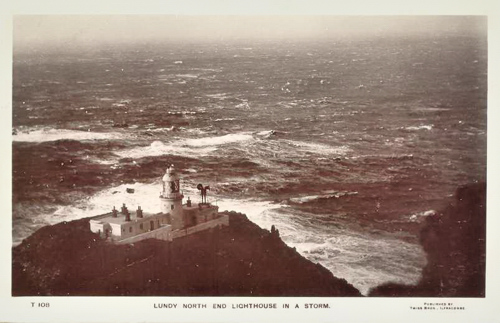
This old postcard suggests
this lighthouse today has changed very little, The Lundy Lighthouses In the extremes of the Bristol Channel, off Devon, is the Island of Lundy, 3.5 miles long by 0.75 miles wide it is said to have 20 miles of dangerous coastline. It is a rugged mass of dark granite, surrounded by reefs of sharp rocks that make an approach to the island difficult for those unfamiliar with it. In 1819 Trinity House decided to build a lighthouse on the rocky summit of Chapel Hill. The granite tower was 96ft high with the keepers houses connected to it, it cost £10,276 19s.11d. The builder was Joseph Nelson, the engineer Daniel Alexander and the Superintendent of Works, James Turnbull. Two lights were shone from the tower, the lower was a fixed white light, the upper was a white quick flashing light, every 60 seconds. This was, at the time, an innovation in lighthouse optics. However, the light revolved very quickly and no period of darkness was detectable between the flashes by most people, so in effect this also appeared as a fixed light. The steady light was from an elevation of 508ft and the flashing at 538ft, being not greatly separated resulted in the lights from a distance of 5 miles or more appearing to be a single light. Mistaking this for a single light was said to have contributed on an evening to a shipping disaster in November 1828. The ship La Jeune Emma travelling from Martinique to Cherbourg, arrived in Carmarthen Bay in thick fog, mistook the Lundy lights for the fixed light of Ushant, and went onto the rocks. Of the 19 people on board 13 were lost including a niece of the Empress Josephine. Continual complaints that the light was completely lost in fog, resulted in the decision to replace it. In 1897 two new lighthouses were built on
the North and South extremities of the island, and the original one,
Lundy Island
(Old Light)
The
Lundy Island South Lighthouse,
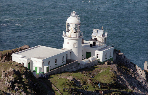
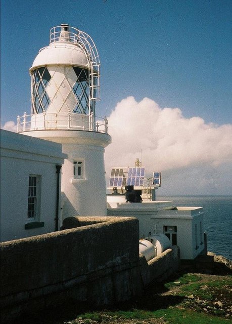
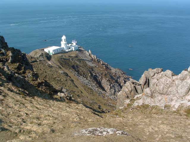
The North Lighthouse (this one) is set on a narrow plateau, on the cliffs. Its a cylindrical brick tower with lantern and gallery attached to two 1 storey keeper's houses. The light was produced from a 75mm petroleum vapour burner until 1971 when electricity was installed. It was automated in 1985 and modernised in 1991 when it was converted to solar power with a new proprietary lantern manufactured by Orga installed on the disused fog signal building. Around the north lighthouse large colonies of guillemots, razor bills and herring gulls make their nests, whilst on the rocks below Atlantic seals take refuge. Both Lundy Lighthouses are now monitored and controlled by a link from Trinity House at Harwich in Essex.
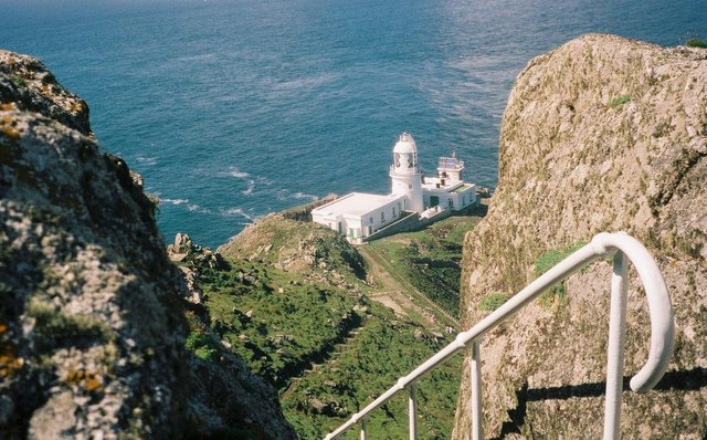
From the steps down to the
lighthouse Only problem is if you go down you have to come back up again!!
Please let us know any other information that we can add to the Grid or page and any errors that you discover. Before making a long trip to any location it is always wise to double check the current information, websites like magazines may be correct at the time the information is written, but things change and it is of course impossible to double check all entries on a regular basis. If you have any good photographs that you feel would improve the illustration of this page then please let us have copies. In referring to this page it is helpful if you quote both the Page Ref and Topic or Section references from the Grid below. To print the planning grid select it then right click and print the selected area. Please submit information on locations you discover so that this system continues to grow.
|
||||||||||||||||||||||||||||||||||||||||||||||||||||||
. |
||||||||||||||||||||||||||||||||||||||||||||||||||||||
|
||||||||||||||||||||||||||||||||||||||||||||||||||||||
|
|
