|

An
English Heritage Site
|
Nunney
Castle
Nunney
Castle is situated in the village of Nunney a small village in Somerset three
and a half miles south west of Frome. It can be accessed at any reasonable time
all year round and you access it through a small gate from the road. It is a
pretty village and as well as the moated castle you can also photograph a
stream, church and other village buildings. Village roads are narrow so parking
is tight, but as it's not one of English Heritages sites which is manned there
are not usually too many other tourists visiting. It is in the centre of the
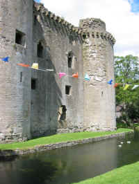
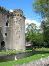
village and the grounds are used occasionally for village activities hence the
bunting in one of the pictures when we visited.
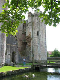  |
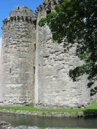
A fortified
manor house built c1373 by John De La Mare it appears to have strong
French influence. Today it is surrounded by a moat, which was restored
in the early part of the 20th century. Originally this would
have been far more substantial, with water extending to the castle
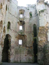
walls. On the ground floor, where remains of a large fire place and side
oven are still visible, and storage facilities in the base of the towers
with a well at one end, is where the kitchen would have been. The first
floor of the tower would have contained the servants quarters. The 2nd
and 3rd floors would have contained the Great Hall and Lord's
Solar, with a Chapel adjoining in the southwest tower. The upper storeys
of the towers would have provided additional accommodation.
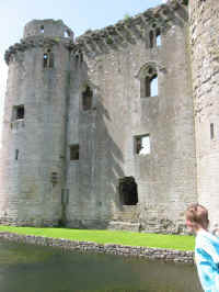
Seventeenth century drawings show that originally
the curtain walls would have been the same height as the towers, at that
time capped with conical roofs. A timber rampart walk extended around
the perimeter of the wall and towers, as the protruding corbels
indicate. The rampart would have stood proud of the wall, supported by
the corbels, and in between each corbel there would have been a hole
allowing various objects to be thrown down onto any attacking force
below. Unusually the curtain wall between the southwest and northeast
towers is so short (about 1m). The main rectangular central void was
capped with a roof with each of the towers having an extra level for
defence. The window surrounds particularly at the higher levels are well
preserved and are typical of those found in domestic residence castles
of the time.
Access to the castle was originally by a
drawbridge (probably made of wooden planks) located in front of the main
door leading to a causeway to the other side of the wider moat than is
present today. It was probably manually drawn into the castle at times
of need.
History
Very little is known and it appears to have
been largely uneventful. The most notable chapter seems to have been
during the Civil War (1645) when it was besieged by Cromwell’s troops,
but capitulated within two days. It was not designed to withstand cannon
and the north wall was soon breached above the entrance, this hole still
remained until 1910 when the fabric finally succumbed to the elements,
causing the bulk of the wall to collapse. After the Civil War, its roof
was removed to render it uninhabitable, and so it has remained ever
since. There are engravings and 19th century watercolours depicting the
wall still standing with a breach at the second floor level.
In 1926 the commissioners of H. M. Office of
Works became guardians of the castle, and repairs that they have
subsequently effected to the building have saved it from the ravishes of
rapid decay that was all to but evident in the early part of this
century. In addition to making safe the standing structure, the interior
and surrounding ground was cleared of the fallen masonry predominately
from the north wall and the moat as seen today re- instated. It is today
in the care of English Heritage.
|
  |
  |
  |
  |
  |
  |
  |
  |
  |
|
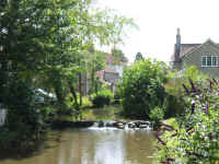
The stream at
Nunney which
feeds the
castle moat. |
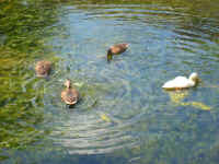
Ducks in the castle moat. |
|
These pictures taken in July 2002, prior
to Nikon DSLR.
Click on
the image to get a larger view. |
|
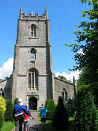
All Saints church in the
village. |
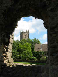
A view of the
church
from inside
the castle. |
Planning Grid
|
Location: |
Nunney
Castle, Somerset |
|
Grid Reference |
ST 737457 - OS
Map 183 |
|
Map Link: |
|
|
Getting there: |
In the centre
of Nunney, 3.5 miles SW of Frome off A361. |
|
Access: |
On foot,
through a gate into the grounds and a footbridge over the moat into the
castle remains. |
|
Parking: |
No car park -
so roadside parking within the village |
|
Facilities: |
Disabled
access to exterior only. Local village has a village shop and pub where you
can pick up some refreshment. |
|
Things To Do,
See and Photograph: |
Remains of a
wet moated castle. Also there are some very quaint cottages and pathways
around the village and small brook which runs through the middle and a
village church. |
|
What to take: |
Camera,
Tripod, shift lens |
|
Nature watching: |
Within the
moat and nearby village brook there are usually some ducks around. |
|
Best Times to
Visit: |
|
|
Address: |
Nunney,
Somerset |
|
Postcode: |
BA11 |
|
Telephone: |
|
|
E-mail: |
|
|
Website: |
Nunney Castle - Somerset |
|
Opening times: |
Any reasonable
time all year. |
|
Charges: |
Free access to
all |
|
Photo
Restrictions and Copyright: |
No commercial
photography is allowed in all their grounds, it is not permitted in some
buildings for conservation purposes, usually a no photography symbol is
present on entry to the building where this restriction is in place. |
|
Other useful
websites: |
|
|
CIN Page Ref: |
Nunney |
Please let us know any other information that we
can add to this Planning Grid or page and any errors that you discover. All our
information is only as up to date as members have provided, so please remember
to tell us of any errors or updates so that we can all benefit by sharing our
knowledge and experience. Before making a long trip to any location it is always
wise to double check the current information, websites like magazines may be
correct at the time the information is written, but things change and it is of
course impossible to double check all entries on a regular basis. If you have
any good photographs that you feel would improve the illustration of this page
then please let us have copies. In referring to this page it is helpful if you
quote the CIN Page Ref at the bottom of the Planning Grid above. To print the
planning grid select it then right click and print the selected area.
Please submit information on locations you discover so
that this system continues to grow.
|