|

An
English Heritage Site
|
Farleigh
Hungerford Castle, Somerset
Click on any of the images to
see a larger version. All images were taken prior to DSLR camera.
|
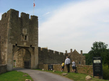 
Outer Gate House
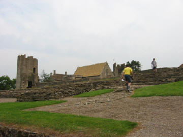 
A view from
the Kitchens
|
Overview
This castle started off life as a Manor House
for the Montfort family. It was sold to Sir Thomas Hungerford
around 1369-70. He converted it into a square castle with large corner
towers surrounded by a moat. In the early 15th Century his son Sir
Walter Hungerford enlarged the property to include an outer court and
the parish church, which he used as a chapel. The Hungerford family
occupied the castle for 200 years, until it was sold to overcome some
family debts. By the 17th century it had fallen into ruin.
It was bought by the Houltons of Trowbridge in
1730 and it remained theirs until 1891 when they sold it to Lord
Donington the husband of Baroness Hungerford, but before long it was
sold to Lord Carins who in 1915 asked the Commissioner of HM Works (now
English Heritage) to become, and who still are, the guardians. |
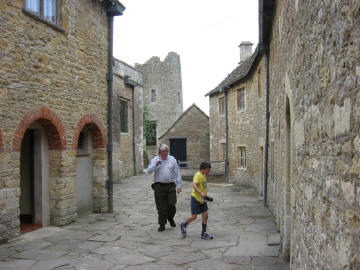 
Cobbled walk to the Chapel
entrance. Part of the buildings on the right is the Priest House which
now contains the Museum with many artefacts which used to be displayed
in the chapel. |
History
The Castle (then a Manor House) and accompanying
village started out known as Farleigh Montfort after the first family to
occupy this part of Somerset. This was until the 14th Century when it
was sold twice, the second time to Sir Thomas Hungerford.
Sir Thomas was a knight and Sherrif
as well as being the first Speaker of the House of Commons. Without
bothering to seek the permission of the King, he proceeded to fortify
the house and had completed the work by about 1380 AD. It was built to
be impressive, to show strength, power and endow the owner with
presence. But also the aim was to appear, even when 'new' that the owner
was of the old money ranks. Thomas Hungerford, was a new kid on the
block but aspired to move in the old established circles.
In 1383, he was pardoned for his "oversight"
of not getting permission to fortify and the fortifications he built are those of the lower
portion, what was to become the inner ward. At each corner of the
original castle was a large round tower and within the inner court yard
numerous buildings. Subdividing the south curtain wall was the original
gate house and draw bridge spanning a deep steep stone line defensive
ditch.
Sir
Thomas lived in the new castle until his death in 1398. He
had favoured the local church by building on to it a chapel dedicated to
St Anne where he was laid to rest. His widow died in 1412 and lies
beside him.
On Sir Thomas' death his son Sir Walter Hungerford,
became the owner of the castle. He was a distinguished soldier and also
Speaker of the House of Commons. In 1426 he was summoned to the House of
Lords, as Baron Hungerford, and it was from this time that Farleigh
became known as Farleigh Hungerford. Sir Walter enlarged the castle by
adding an curtained wall to create an Outer Court, and this enclosed the
parish church. He also endowed two chantries and built a house for the priests
to the east of the church, which now houses the museum. |
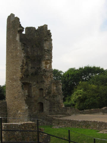 
NorthWest Tower
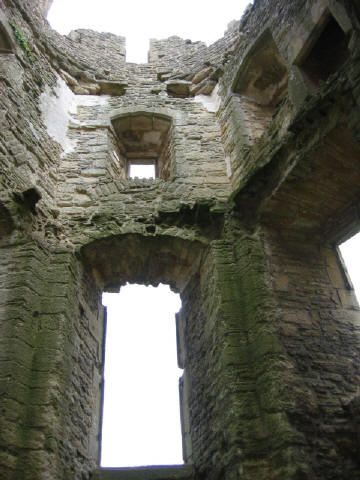 
A view from
inside one of the 4 towers.
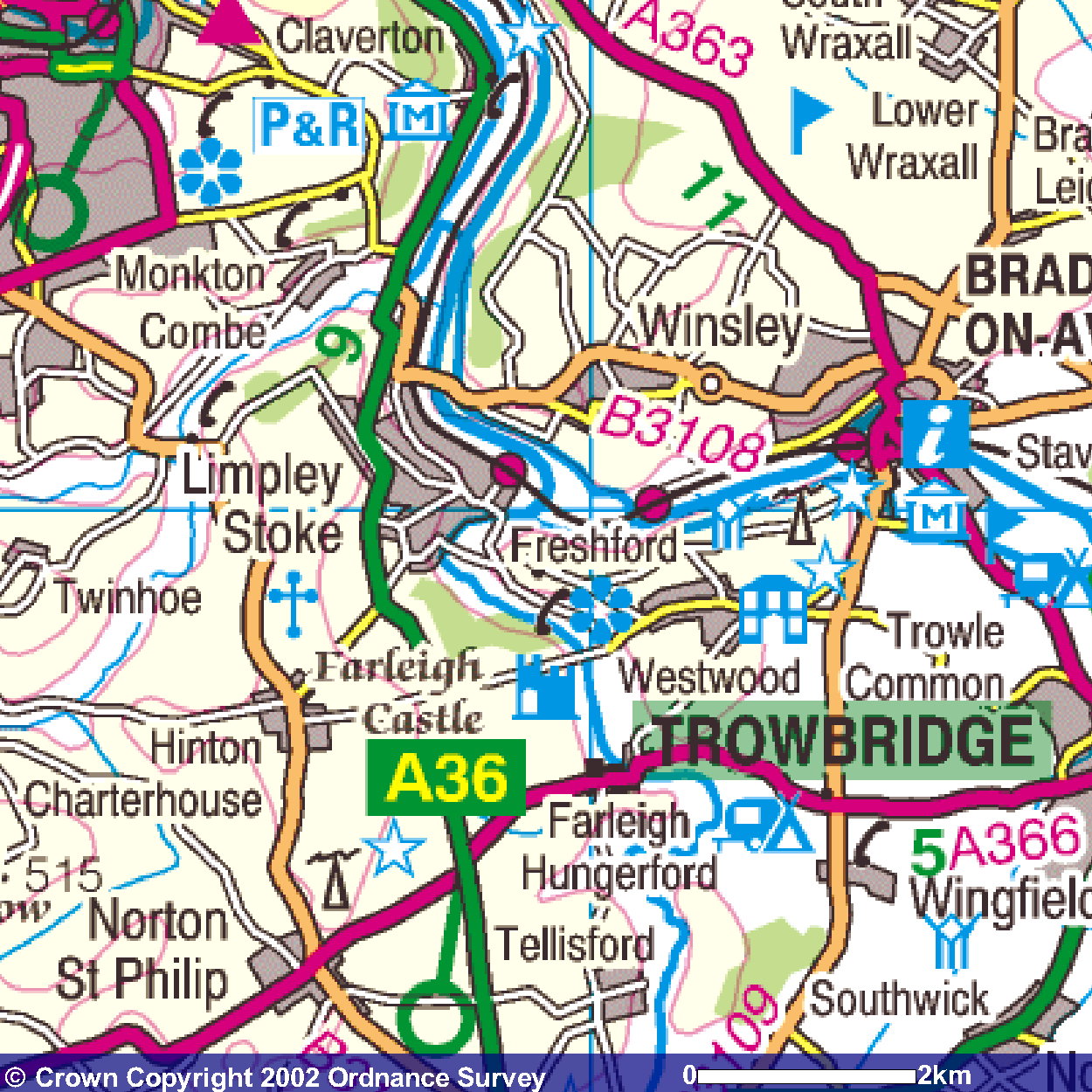
OS map of the
area showing the location of Farleigh Hungerford. |
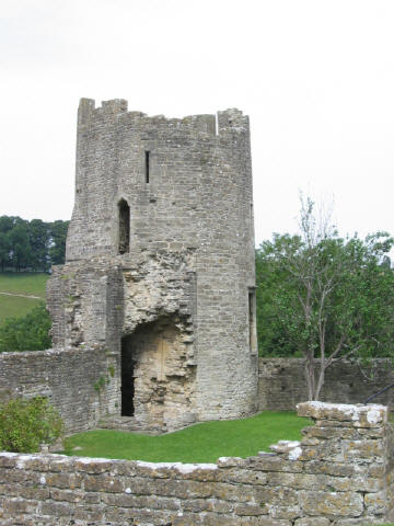 
South-East Tower
|
The Castle Chapel
Originally this was the Parish church and when it
became enclosed by the Outer walls added by Sir Walter it became the
Hungerfords private chapel of St Leonard and a new parish church was
built out side the castle wall for the local parishioners.
What is interesting about this small ex-parish
church is the fact that it remains to a large extent as it was in
medieval times, unlike many parish churches that were renovated by the
Victorians.
Wall paintings can be seen as well as the original
wrought iron railings around the tomb. Beneath the private chapel, is a
crypt occupied by the decedents of the Hungerford family.
|
|
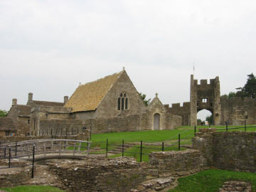 
St Leonard Chapel with the
Outer Gatehouse behind.
|
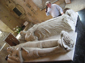 
Some of the tombs of the
Hungerford family. |
|
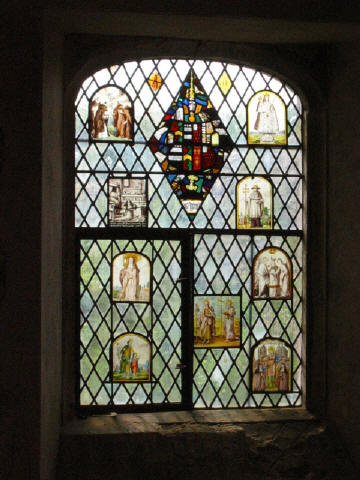 
One of the many painted Chapel
Windows.
|
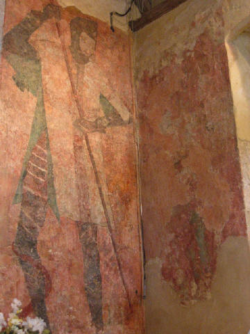 
Chapel Wall Painting c1440 |
|
Sir Walter Hungerford died in 1449. The history of
the Hungerfords and the deeds carried out at the castle are colourful
and were at times sinister including murders and prisoners held with
little food are just two instances within the life of the castle.
During the Civil War the heir to the castle,
Sir Edward, commanded the local forces of Wiltshire for Parliament in
1642-45, while his half brother John, was a Royalist, and so was put in
charge of a garrison at Farleigh late in 1644. The garrison was
dependent on Bristol, and on the 15th September 1645, four days after
Prince Rupert had surrendered Bristol, Sir Edward reduced Farleigh,
apparently without bloodshed. What followed was a period of uncertainty
for the castle as the Hungerfords swayed between Royalist and
commonwealth tendencies. In the end it was raided by the
Government and arms and armour were seized.
In 1686 the castle was sold because of
financial difficulties incurred by gambling by the then heir. By 1701 it
was in a ruin state. Since it has been owned by the Houltons of
Trowbridge from 1730-1891, and in 1891, Lord Donington, whose wife was
Baroness Hungerford, but before long it was sold to Lord Cairns,
who in 1915 put it in the guardianship of the Commissioner of Works. Now
English Heritage have guardianship of the property and it is open to
visitors most days.
Farleigh Hungerford Castle has had a colour
history and although mainly a ruin today, the audio tour brings the site
into your imagination and tells you the story of its past. The Chapel is
still fully intact and is a delight to view although a little chilly.
The museum has a model of what it is believed to have looked like as
well as information boards and some costumes and amour from the period.
It is well worth a visit. |
Click on any of the above
images to see a larger version. All images were taken prior to DSLR camera.
Planning Grid
|
Location: |
Farleigh
Hungerford Castle, Somerset |
|
Grid Reference |
ST 801576 - OS
Map 173 |
|
Map Link: |
|
|
Getting there: |
In Farleigh
Hungerford, 3.5 miles W of Trowbridge on A366. |
|
Access: |
Car park is
just past the main entrance through the Outer Gatehouse. |
|
Parking: |
It has it's
own free car park nearby. |
|
Facilities: |
Audio Tour, Toilets, Shop, snacks from shop, picnics allowed in
grounds. |
|
Things To Do,
See and Photograph: |
Remains of
medieval fortress, castle chapel and its wall paintings and Priests House
which contains a little museum of artefacts and costumes. |
|
What to take: |
Camera, Tripod |
|
Nature
Highlights: |
Nearby the
River Frome and a weir |
|
Best Times to
Visit: |
Out
of main summer season when it may be quieter of visitors. Main castle ruins
are not covered so need a dry day. |
|
Address: |
Farleigh
Hungerford, Somerset |
|
Postcode: |
BA2 7RS |
|
Telephone: |
01225 754026 |
|
E-mail: |
|
|
Website: |
www.english-heritage.org.uk/farleighhungerford |
|
Opening times: |
1 Apr -30 Jun
and 1st-30 Sept daily 10am to 5pm
1Jul-31 Aug daily 10am to 6pm;1st-31 Oct daily 10am to
4pm
1
Nov-20 Mar Sat-Sun 10am to 4pm
Closed 24-26 Dec and 1 Jan |
|
Charges: |
English
Heritage Members - Free; Non-Members Adults £3.50; Concessions £2.60;
Children £1.80 |
|
Photo Restrictions: |
No commercial
photography is allowed in all their grounds, it is not permitted in some
buildings for conservation purposes, usually a no photography symbol is
present on entry to the building where this restriction is in place. |
|
Other Restrictions: |
|
|
Special Needs Access: |
Grounds via impacted gravel, tarmac, paved and
earth paths and fairly smooth grass. Some cobbled areas. Wheelchair access
confined to top lawns. Chapel and Priests House ground floor only. |
|
Special Needs Facilities: |
Disabled toilets. Disabled car park 20m from
entrance on a tarmac surface. |
|
Children Facilities: |
|
|
Dogs Allowed: |
No dogs allowed on site |
|
Other useful
websites: |
|
|
CIN Page Ref: |
Farleigh |
Date Updated: 02/08 |
Please let us know any other information that we
can add to this Planning Grid or page and any errors that you discover. Before making a long trip to any location it is always
wise to double check the current information, websites like magazines may be
correct at the time the information is written, but things change and it is of
course impossible to double check all entries on a regular basis. If you have
any good photographs that you feel would improve the illustration of this page
then please let us have copies. In referring to this page it is helpful if you
quote the CIN Page Ref at the bottom of the Planning Grid above. To print the
planning grid select it then right click and print the selected area.
Please submit information on locations you discover so
that this system continues to grow.
|